 Queenstown City Guide
Ben Lomond Track: Saddle, Summit and the Uplift Shortcut
The Ben Lomond Track is the big one above Queenstown: a marked route from the top of Brecon Street to a 1,748 m summit, which the Department of Conservation grades an advanced tramping track with 1,438 m of elevation gain and a 6 to 8 hour return time. There is no ticket and no gate. The one decision that matters is where you stop, because the shortcut everybody has heard about reaches the 1,326 m saddle and no further. The rest of the district's walking is on the Queenstown walks hub, the shorter climb most short-trip visitors should do instead is the Queenstown Hill walk, and this track is one entry in our independent guide to Queenstown, New Zealand.
Quick answer Times, the climb, the shortcut that is not one, and what the weather does
The Department of Conservation publishes 6 to 8 hours return to the Ben Lomond summit from Queenstown, with 1,438 m of elevation gain, and grades the route an advanced tramping track needing high fitness on a steep gradient. Riding up to the Skyline complex first cuts that to 3 to 4 hours return — but only as far as the 1,326 m saddle. DOC publishes no assisted time to the summit at all.
Key takeaways
- Decide saddle or summit before you leave town: the four routings DOC publishes put the difference at roughly three hours and 400 vertical metres, and the section above the saddle crosses private land, gets rougher and holds snow longest.
- Nothing is sold on the track. The only fare is the uplift, and its adult, child and one-way-down prices sit on the uplift and luge price page with the operator's weekly opening table on the complex guide.
- Water is the fact that catches people out: DOC states there is no water past the top complex, so everything you drink on a seven-hour day goes up in your pack.
- If today is windy, wet or snowy above the bushline, take the three-hour hill walk on the other side of town instead, or spend the height on the six-line zipline through the beech canopy below the summit ridge.
Key facts
Opening hours
| The track, all year | Always open–No gate, no closing time |
|---|---|
| Skyline uplift, week of 7 to 13 September 2026 (published weekly) | 09:30–21:00 last boarding |
Closed None. DOC publishes no seasonal closure, but warns of snow and ice above the bushline from April to November
Admission
- Adult
- Free — public conservation land, no track fee of any kind
- Reduced
- —
- Free
- Everyone walking. The optional uplift to the top complex is $40.30 (NZ$69) adult, $28.00 (NZ$48) child, and a one-way ride downhill can be bought
Planning it
- Time needed
- DOC: 6 to 8 hours return to the summit from Queenstown, 5 hours return to the saddle, 3 to 4 hours return to the saddle from the top complex
- Book ahead
- Optional — walk-up usually fine
- Address
- Track start: the Tiki Trail beside the Skyline gondola base station at the top of Brecon Street, Queenstown 9300
Prices on this site are US dollars first with the New Zealand dollar in brackets, at NZ$1 = $0.584 (European Central Bank rate). Nobody sells a ticket to Ben Lomond, so this compares what each way onto the hill costs and what DOC's own times say it buys.
Are you buying height, or buying a whole day?
| Way onto the hill | Price | What DOC's time buys | Cancel | Book |
|---|---|---|---|---|
| Walk it from Brecon Street, Tiki Trail upAnyone with a full day, alpine-capable clothing and the fitness DOC calls high | Free | 5 hours return to the saddle, 6 to 8 hours return to the summit, 1,438 m of climbing | Nothing to cancel | Official site |
| Ride up to the top complex, then walkWalkers who want the alpine view without the forest climb, and who are stopping at the saddle | $40.30 (NZ$69) adult, $28.00 (NZ$48) child | 3 to 4 hours return to the saddle, 7 km return — DOC publishes no assisted summit time | Operator's own terms | Official site |
| Walk up the Tiki Trail, ride one way downSummit walkers whose legs have had enough by the time they are back at the complex | One-way downhill fare, sold at the complex | Saves the descent on tired knees after a summit day | Operator's own terms | Official site |
| Six-line zipline tour on the same hillside, 3 hoursAnyone who wants the hill without the seven-hour day, or a plan B when the tops are in cloud | From $122.33 | Guided descent through the forest the track climbs, harness and helmet included | Free up to 24 hours before | Check Availability |
| Tandem paraglide off the hill, 1.5 hoursWalkers happy to reach the complex and fly rather than walk back down | From $215.99 | The only paid way down that skips the descent entirely | Free up to 24 hours before | Check Availability |
Track figures come from DOC's Ben Lomond page and its March 2025 brochure, the uplift fare from the operator's own shop, the platform cards from their listed prices, all read on 8 September 2026. The official rows link DOC and the operator with nothing added. DOC attaches no fee to the track and no permit to the summit.
What is actually bookable on this hillside
Not one of these is a guided ascent of Ben Lomond — no operator on the platform sells one, which is worth knowing before you go looking. These are the paid activities that share the hill and the ridge, in the order they suit a walker's day, with the operators' own ratings and the prices listed on 8 September 2026. Each card's home page is linked in the blocks below.
 from $122.33
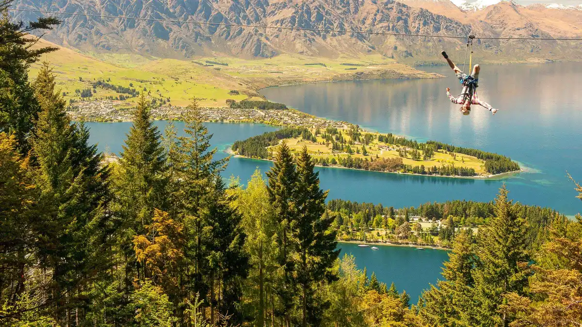
Queenstown: 3-Hour Zipline Adventure with 6-Lines
Six tree-to-tree lines running the whole way from the gondola summit down to the base, so you finish in town rather than back at the top. Three hours, and the longest of the three zipline options.
Check Availability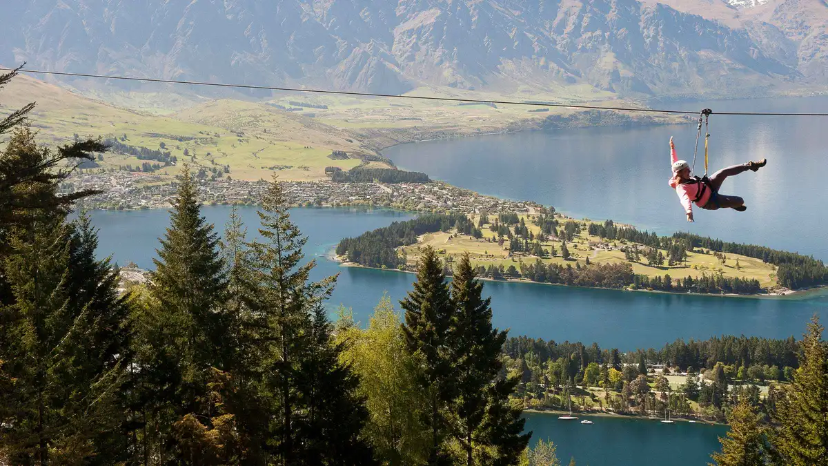 from $93.07
Queenstown: 2-Hour Zipline Tour with 4-Lines
Four lines that get longer, higher and faster as they go, starting and finishing at the top of the gondola, with the gondola ticket in the price. Two hours, and the one the operator points first-timers at.
Check Availability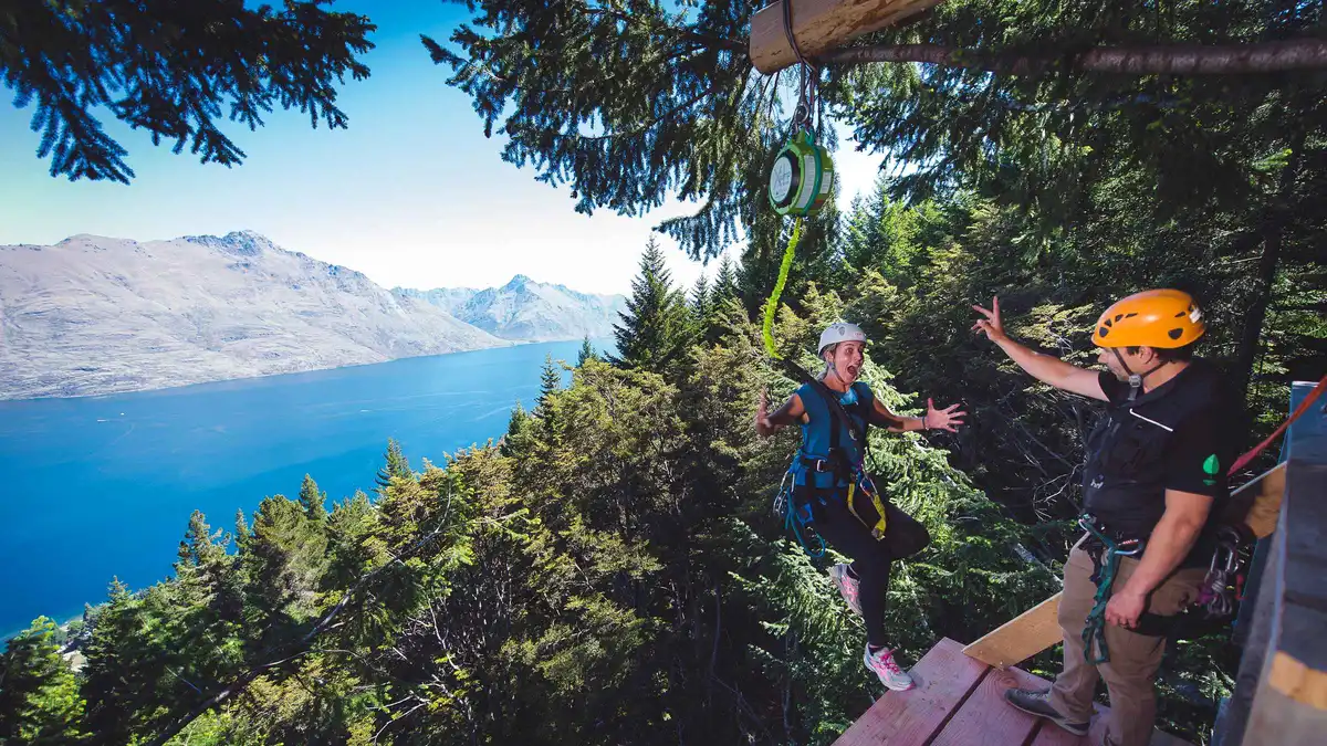 from $69.65
Cheapest way in
from $69.65
Cheapest way in Queenstown: 1-Hour Zipline Tour with 2-Lines & 21-Meter Drop
Two lines and a 21-metre controlled drop to the forest floor, done in an hour, with a 10-minute uphill walk built into it. Gondola ticket included, and the smallest commitment before a longer tour.
Check Availability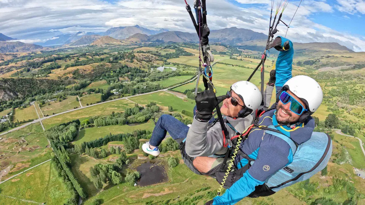 from $215.99
Most booked
from $215.99
Most booked Queenstown: Tandem Paragliding Experience
The standard tandem flight, launched off Coronet Peak with transfers from Camp Street and the photos and video handed over afterwards. About 90 minutes in total, most of it spent getting up the hill.
Check Availability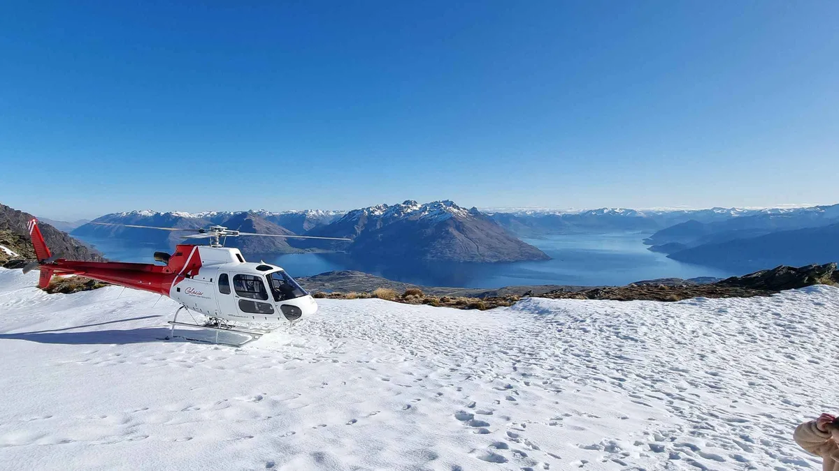 from $179.11
Queenstown: Remarkables Helicopter Flight & Alpine Landing
Twenty minutes in the air with a landing on the Remarkables Spur at around 5,000 feet, the shortest helicopter option on this page. You get out on the ridge for the view over the Wakatipu Basin.
Check AvailabilityPrices, ratings and details are the platform's own, checked in Q3 2026; dollar figures are the listed prices — the platform bills in your account's currency.
The Four Routings DOC Publishes, Side by Side
This is the whole decision on one grid. Every time and distance below is the Department of Conservation's own, taken from its Ben Lomond track page and from the March 2025 brochure Queenstown day walks and bike trails; the elevation figures are DOC's too. Where its two publications disagree, both numbers are printed.
DOC's brochure carries a caveat that should be read before any of these numbers: all times and distances are one way unless stated otherwise, and the times are an approximate guide only. On this track DOC does state return figures, which is why the table below reads in return hours.
| Routing | DOC time | DOC distance | Height gained | Cost |
|---|---|---|---|---|
| Tiki Trail to the summit, from town | 6 to 8 hr return | 14 km return on the track page, 11 km return in the page summary, 13 to 15 km in the brochure | 1,438 m to the 1,748 m summit | Free |
| Tiki Trail to the saddle, from town | 5 hr return | 10 km return on the track page, 11 km in the brochure | About 1,016 m to the 1,326 m saddle | Free |
| Uplift to the top complex, then the saddle | 3 to 4 hr return | 7 km return | Not published — the ride takes you to the Bobs Peak complex at 1,089 m | $40.30 (NZ$69) adult |
| Uplift to the top complex, then the summit | Not published by DOC | Not published by DOC | Not published | $40.30 (NZ$69) adult |
How to read the last row
The empty row is the most useful line on this page. DOC gives an assisted figure for the saddle and stops there; it publishes no assisted time, distance or gain to the summit. So a walker planning a summit day has one number to work from, and it is the full 6 to 8 hours from town. The uplift removes the forest section, which is the easiest and least exposed part of the climb, and leaves every hard metre above the bushline where it was.
Our own routing, labelled as ours and not DOC's: if you ride up and walk on to the summit, budget the difference between the two saddle figures — roughly an hour and a half of the return trip — and plan a five to six and a half hour day from the top complex, with a hard turnaround time written down before you start.
Which one to pick
For a first visit with a fixed itinerary, take the assisted saddle route: 3 to 4 hours, the whole lake below you, and a bailout at the complex with toilets and a cafe at the end of it. Take the full summit day only if you have the alpine clothing DOC asks for, a settled forecast, and no plane to catch that evening. If you want a big walk and the forecast is marginal, Queenstown Hill is a different scale of day at 2 to 3 hours and about 500 m of climbing.
The Uplift Does Not Shorten The Summit, And DOC Says So Twice
The sentence that shapes half the misinformation about this track sits on DOC's own page: ride the gondola to the Skyline complex and hike to the Ben Lomond Saddle and back, 3 to 4 hours return, 7 km return. DOC adds its own reason for the routing, and it is not a shortcut to the top: it calls the assisted saddle trip a good option for trampers who would like to take in the views while building the fitness and experience required to hike to the summit.
Read that again. The assisted routing is DOC's training run for the summit, not its version of the summit. Yet the phrase people carry away from a blog or a search summary is that the uplift turns Ben Lomond into a half-day walk, and the two figures — 3 to 4 hours, and a photograph taken at 1,748 m — get welded together into a plan nobody has published.
Two DOC publications, three distances
There is a second, smaller trap in the numbers. DOC's own track page carries a summary reading 11 km return, 6 to 8 hr return to Ben Lomond Summit from Queenstown, while the route description further down the same page gives 14 km return for the same trip. The March 2025 brochure gives the summit as 13 to 15 km return and the saddle as 11 km.
The times never move — 5 hours to the saddle, 6 to 8 hours to the summit, in every version — so plan on the clock, not the kilometre count, and treat any single distance quoted elsewhere as one of several. We print all of them rather than pick a favourite, because the choice would be ours and not the authority's.
What the section above the saddle is actually like
In DOC's words: beyond the saddle is Ben Lomond Station, where the track crosses private land and is unmaintained; the terrain becomes steeper and rougher; the hardest part of the climb remains as you approach the 1,748 m summit; and there are steep drop-offs from the track, more treacherous when covered in snow and ice. DOC asks walkers to keep to the formed track through the station land to avoid disturbing stock. Its blunt line about pacing belongs on every summit plan: the peak is only the halfway point.
How Hard It Is, In The Authority's Own Grading
DOC grades the Ben Lomond Track an advanced tramping track. On the same page it prints fitness required: high, and gradient: steep. It describes the trip as a demanding climb and a full day's hike with 1,438 m of elevation gain when completed from Queenstown. Those four statements together are the honest answer to the question people ask most, which is whether a reasonably fit person who walks a bit at home can do this.
The height gain is the number to sit with. It is more than a kilometre and a third of vertical, done on foot, in one direction, on a track that starts among Douglas fir and ends on loose alpine ground. For comparison inside this district, DOC gives Queenstown Hill about 500 m of climb, and Roys Peak near Wanaka over 1,200 m — Ben Lomond from town is bigger than either.
Where the track changes character
The climb has three sections and they are not equally hard. The Tiki Trail zigzags up through pine forest from behind the cemetery wall on Brecon Street, and DOC's own word for it is steep: 2 km one way, an hour. At about 800 m the trees stop and the route enters alpine tussock and shrubs, which is where wind starts to matter.
The saddle at 1,326 m is a natural end point. Above it comes the unmaintained station land, the loose ground and the drop-offs. If you are turning around anywhere, turn around at the saddle.
Snow, Wind And The Warning DOC Prints In Full
This is the section that belongs above every other on an alpine track, and the wording is the authority's, not ours.
DOC states plainly that the weather changes rapidly in this region and hypothermia is a real risk even in summer. For winter it is more specific: you will need to carry and be able to use alpine equipment such as avalanche equipment, an ice axe and crampons, and the track may change between very slippery and muddy. Ben Lomond is a summer walk and a winter mountaineering route, and the calendar does not tell you which one you have got — the forecast does. Snow and ice sit above the bushline from April to November, eight months in which the top half of this track can be a different proposition from the one in the photographs.
There is no wind threshold at which it closes, because it never closes: nothing is gated and nobody is checking. On a day when the tops are in cloud, the sensible move is the assisted saddle routing at most, or the three-hour climb on the eastern side, which sits well below the snowline.
- Check the forecast for the track itself, not for the town: DOC links a NIWA point forecast for the Ben Lomond Track from its own page, and the tops run far colder and far windier than the lakefront.
- Watch the New Zealand Mountain Safety Council's walk-through film for this track before a first attempt — DOC points to it by name and it covers facilities, decision points and typical conditions.
- Leave your intentions with someone and carry a way to call for help; DOC's own outdoor-safety line asks for both.
- Fires are banned on the hill year round. The area between Rat Point and Arthurs Point, Ben Lomond included, is a designated High Fire Risk Zone.
Water, Toilets And The Last Ride Down
DOC publishes exactly two toilets on this hill: one at the top complex of the gondola, and a newer one 100 m before the Ben Lomond saddle. Neither is stocked for you — DOC's wording is that you take your own supplies, and no water, hand sanitiser or toilet paper is provided.
The water line is the one that decides packs: pack enough water for the day, there is no water past the Skyline gondola complex. For a 6 to 8 hour day on an exposed tussock face in January that is a serious carry, and there is nowhere on the route to correct the mistake.
Daylight and the ride down
DOC asks walkers to leave enough daylight hours and to pack a headtorch anyway. It also records that the uplift can be used as a one-way ticket downhill, which is the single most useful piece of logistics on this page for anyone who has just come off the summit.
What we cannot print is the last downhill departure. The operator publishes its opening hours only as a rolling week-by-week table rather than fixed seasonal hours — for the week of 7 to 13 September 2026 that table showed the gondola running 09:30 to 21:00, with the closing time being the last boarding — and it warns that hours vary with weather, maintenance and construction. So check the current week on the complex page before you count on riding down, and read the fares on the price page if you want to buy the one-way in advance.
The other rules on the hill
No dogs, anywhere on the track — DOC states it flatly. No drones without a permit. And the hazard nobody expects on a walking track: numerous steep downhill mountain-bike tracks cross it, and DOC says the speeds make those crossings unsafe for walkers, so follow the signs and orange markers.
Animals have formed their own tracks across the mountain, which is DOC's reason for that marker warning.
Reaching The Trailhead Without A Car
The main trailhead is the easiest in the district to reach on foot: the Tiki Trail starts beside the gondola base station at the top of Brecon Street, a few minutes uphill from the town centre, behind the stone wall of the cemetery. No parking problem, no shuttle, no gravel road.
DOC lists four access points in its own order of preference: the Tiki Trail, which it marks as the best option; the bottom of the Skyline Access Road on Lomond Crescent; the One Mile Creek Track from the Fernhill roundabout, which DOC flags as requiring navigation; and the gondola itself, return or one way downhill.
| Access point | How to get there without a car | Fare | DOC's note |
|---|---|---|---|
| Tiki Trail, top of Brecon Street | Walk from the town centre | Free | Best option |
| Lomond Crescent, foot of the Skyline Access Road | Walk from the town centre | Free | Second listed access |
| One Mile Creek Track, Fernhill roundabout | Orbus route 1 towards Sunshine Bay | $1.46 (NZ$2.50) on a Bee Card, $2.34 (NZ$4) cash | Navigation required |
| Top complex, by uplift | Walk to the base station, then ride | $40.30 (NZ$69) adult | Return, or pay for a one-way ticket downhill |
The bus, in one paragraph
Orbus route 1 runs Sunshine Bay to Remarkables Shops through the town centre from 06:02 until 00:25, roughly every fifteen minutes until early evening, seven days a week. The fare is $1.46 (NZ$2.50) with a Bee Card against $2.34 (NZ$4) in cash, and the card costs NZ$5 with a NZ$5 minimum top-up, so it pays for itself inside two rides — how the buses, the ferry and the fares work has the routes and the transfer rule. For the Fernhill approach, ride route 1 to the roundabout and pick up the One Mile Creek Track there; DOC's brochure gives that walk as 1 hour to 1 hour 30 minutes return over 1.9 km in its own right.
Ben Lomond, In Eight Decisions
Every line here is argued somewhere above; this is the version to read on the morning.
Do
- Decide saddle or summit at breakfast and write a turnaround time on your hand — DOC's own line is that the peak is only the halfway point.
- Carry every litre you will drink: DOC states there is no water past the top complex.
- Check the NIWA forecast DOC links for the track itself, not the town forecast, and read the alpine warning before you commit.
- Take the uplift if you are stopping at the saddle — it is DOC's own recommended way to build up to the summit, and the fares are on the price page.
- Pack a headtorch even on a summer morning; DOC asks for one on top of leaving enough daylight.
Don't
- Do not plan a summit day around the 3 to 4 hour figure. That number is the saddle, and DOC publishes no assisted summit time.
- Do not step onto a downhill mountain-bike line to shortcut a zigzag; DOC calls those crossings unsafe for walkers because of the speeds.
- Do not attempt the section above the saddle between April and November without ice axe, crampons and avalanche equipment, which DOC lists by name.
- Do not bring a dog. No dogs on this track, without exception.
Sources: DOC's Ben Lomond Track page and its March 2025 brochure Queenstown day walks and bike trails, both read on 8 September 2026.
Five Things Most Visitors Do Not Know
Each of these is sourced in brackets, because a claim about an alpine track is worth nothing without one.
- There is a toilet 100 m below the saddle, and it is new enough that most trip reports predate it (DOC, Ben Lomond Track page).
- The section between the saddle and the summit crosses a working farm, Ben Lomond Station, and is unmaintained (DOC, Ben Lomond Track page, and the March 2025 DOC brochure).
- The Maori name recorded for Ben Lomond and Fernhill is Te Taumata-o-Hakitekura (DOC, Queenstown day walks and bike trails brochure, March 2025).
- From the summit DOC names Ka-kamu-a-Hakitekura/Cecil and Walter Peaks and the Kawarau/Remarkables, with Pikirakatahi/Earnslaw and Tititea/Aspiring visible in fine weather (DOC, Ben Lomond Track page).
- The whole hillside sits inside a designated High Fire Risk Zone with a year-round ban on outdoor fires, from Rat Point to Arthurs Point (DOC, Ben Lomond Track page).
- The gondola shortcut is not the only assisted option in the district: DOC's Lake Alta Track at the Remarkables ski area is 1 hour 30 minutes return for 2.4 km from a car park at about 1,600 m, which is the shortest way to stand in an alpine cirque near Queenstown (DOC brochure entry 34, and the Remarkables page).
Trailhead, Saddle And Summit On The Map
Pins mark the access points DOC lists and the reserve the track climbs through. The summit carries no published coordinate: LINZ holds two Unofficial/Recorded Otago features named Ben Lomond and returns no single point for the peak, so nothing here is pinned as the summit.
Coordinates: LINZ NZ Gazetteer for the reserve and for Queenstown Hill; OpenStreetMap for the Brecon Street base station, which the operator publishes as a street address only.
What Else Is On This Hill, And What To Do Instead
Walking minutes are our estimates from the trailhead at the top of Brecon Street.
The complex at the top of the hill
The same ridge without the climb: cafe, restaurant, toilets and the luge track. The complex guide covers what is up there and the price page carries the fares, including the one-way downhill ticket DOC mentions.
1 hour up the Tiki Trail, or one rideQueenstown Hill
DOC gives 2 to 3 hours return and about 500 m of climb over 5.4 km, on a council-managed track that stays below the snowline. The Queenstown Hill walk is the right substitute on a marginal day, and the honest one for a short trip.
25 min walk across town to Belfast TerraceEvery walk in the district
Twelve tracks with DOC's own times, grouped by where they start, including the lakeshore ones that work in bad weather. The walks hub also prints the two places where DOC and the trail trust publish different lengths for the same route.
The index, not a placeBen Lomond Track Questions
How long does it take to summit Ben Lomond?
DOC publishes 6 to 8 hours return from Queenstown, with 1,438 m of elevation gain. That figure assumes you walk the whole thing from Brecon Street, and DOC gives no shorter assisted version of it. The routing table sets it beside the saddle times so you can see where the hours go, and DOC's own pacing note is that the peak is only the halfway point.
How difficult is the Ben Lomond Track?
DOC grades it an advanced tramping track, prints fitness required: high and gradient: steep, and describes it as a demanding climb and a full day's hike. Above the saddle the track crosses private land, is unmaintained, gets steeper and rougher, and has steep drop-offs. How hard it is, section by section breaks the climb into its three parts.
Can beginners climb Ben Lomond?
A beginner in good general health can reach the saddle on a settled summer day, which is exactly what DOC recommends the assisted routing for: building the fitness and experience required to hike to the summit. The summit itself is an advanced tramping grade and not a beginner's objective. If you want a first big walk in this district, Queenstown Hill at 2 to 3 hours is the one to start with.
How long is the Ben Lomond Track from the gondola?
DOC's assisted figure is 3 to 4 hours return over 7 km, and it reaches the Ben Lomond Saddle at 1,326 m, not the 1,748 m summit. No assisted summit time exists in any DOC publication. The routing table prints the empty cell rather than filling it with a guess, and the uplift fares sit on the price page.
Is there water on the Ben Lomond Track?
No. DOC states there is no water past the Skyline gondola complex and asks walkers to pack enough for the day. There are two toilets — one at the top complex, one 100 m before the saddle — and neither provides water, hand sanitiser or toilet paper. The supplies section has DOC's full wording.
When does the Ben Lomond Track have snow?
DOC's instruction is to be prepared for snow and ice above the bushline from April to November, and in winter to carry and be able to use avalanche equipment, an ice axe and crampons. It also warns that hypothermia is a real risk even in summer. The weather section carries the full warning and the forecast DOC points to.
Which is harder, Ben Lomond or Roys Peak?
By the only figures the authority publishes, Ben Lomond from Queenstown is the bigger climb: 1,438 m of gain against DOC's over 1,200 m for Roys Peak, and Ben Lomond is graded an advanced tramping track. The comparison stops there, because DOC publishes no distance and no walking time at all for Roys Peak, and it closes that track from 1 October to 10 November for lambing. Roys Peak sits near Wanaka; the Wanaka page covers the drive.
Where This Fits In A Queenstown Trip
On a three-night trip, Ben Lomond takes one whole day and shapes the one after it. The summit routing puts you back in town in the late afternoon with tired legs; the assisted saddle routing costs a morning and leaves the afternoon intact. Neither works as a filler between two other bookings.
If your trip is short, the climb on the eastern hill delivers the same postcard for a third of the effort, the walks hub has a dozen shorter tracks with DOC's times attached, and the buses that reach the outlying trailheads are in getting around Queenstown.
The Track On Film, Including The Safety Council's Own Walk-Through
Three films that answer what a photograph cannot: how steep the forest section really is, what the ground above the bushline looks like, and how the assisted routing plays out. Ids copied from our verified list.
Ben Lomond Track: Alpine Tramping Series
The New Zealand Mountain Safety Council walk-through DOC itself points walkers to, covering conditions, decision points and hazards along the route.
Video: NZ Mountain Safety CouncilBen Lomond Track via the gondola
The assisted routing filmed end to end, which is the best way to judge whether the saddle is enough of a day for you.
Video: The Unanchored PassengerBen Lomond Track, Queenstown: the full hike
Forest, tussock, saddle and the last rough climb, in the order you will meet them on a summit day.
Video: The BeachpackersVideos load from YouTube only when you press play.
Reviewed Q3 2026 (July–September 2026); next review Q4 2026. Prices, hours and terms are set by the venue or operator and confirmed at checkout.
We may earn a commission if you book through one of our links, at no extra cost to you. Full affiliate disclosure