 Queenstown City Guide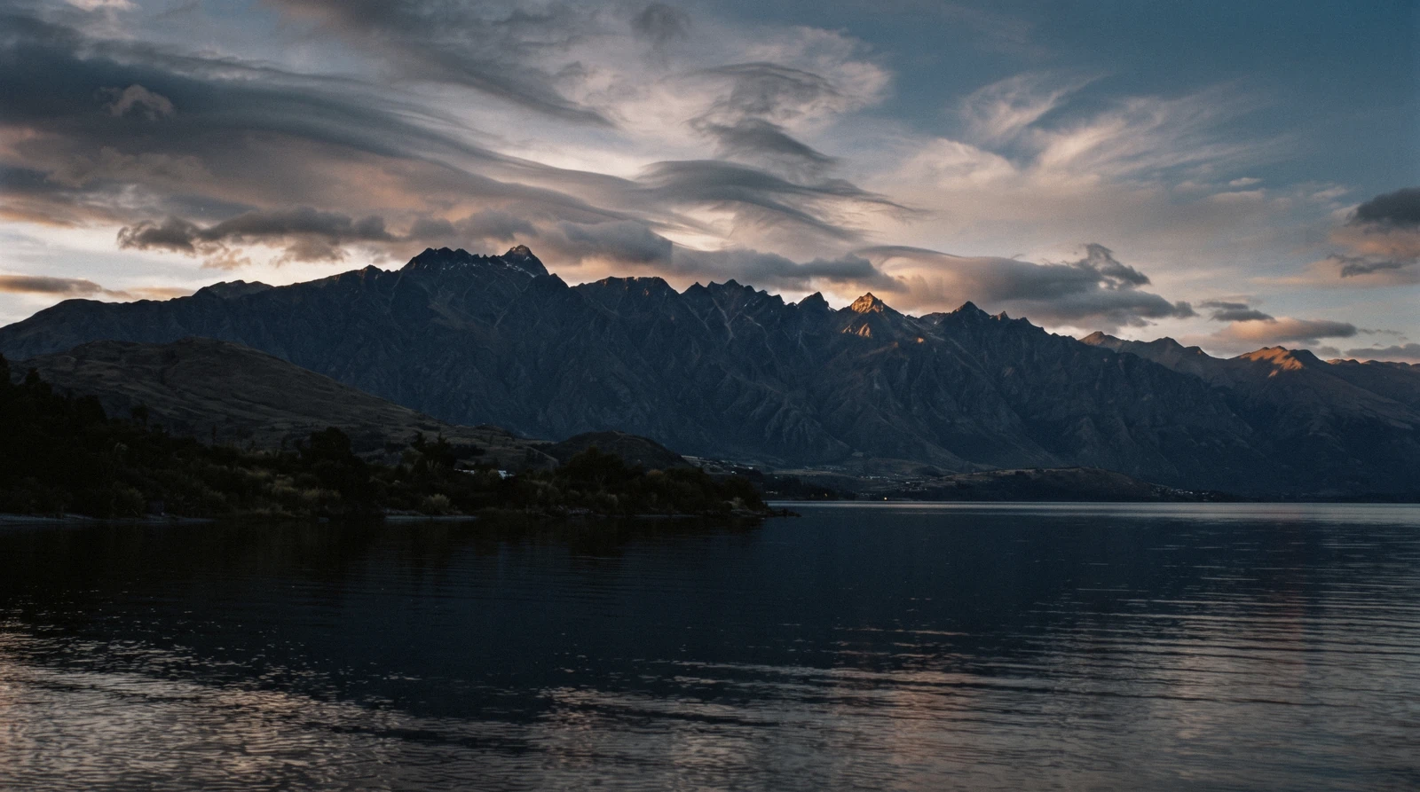
The Remarkables: the Range Queenstown Looks At, and the Ski Field On It
The Remarkables Queenstown sees from its waterfront is a mountain range and a ski area, and the two need separating before anything else makes sense: the range is a Department of Conservation area whose high point, Double Cone, is printed at 2,307 metres on DOC's own map, and the ski field is one of three mountains NZSki sells on a single pass. This page carries both, with the access road, the summer track, the season dates and the figures nobody publishes, read on in Q3 2026. The mountain on the other side of the valley is on the Coronet Peak page, and everything else this town does is on the Queenstown guide we keep.
Quick answer The range, the ski field, the road and the summer walk
The Remarkables is the 2,307-metre wall of rock on the far side of Lake Wakatipu from Queenstown, and separately the name of the ski area on its western flank, 24 kilometres and about 45 minutes from town. On this site a bare dollar figure is US dollars with the New Zealand price in brackets, converted at NZ$1 = $0.584. A full ski day is $105.10 (NZ$180), the ski season runs 13 June to 11 October in 2026, and the last stretch of the access road is gravel with a standing instruction to carry chains whatever the weather looks like in town.
Key takeaways
- There is no separate day rate for this ski area. NZSki sells one Superpass across three mountains, so the pass table shows the same figure you would pay at the field across the valley
- The summit figure in wide circulation, 2,319 metres, has no official source we could find; DOC's own brochure map prints Double Cone at 2,307 metres, and that is the number this page uses
- In summer the ski field publishes nothing, but DOC does: the Lake Alta Track is 2.4 kilometres return in about 90 minutes, and the same drive carries a road toll nobody publishes an amount for
- One booked flight lands on this range: the alpine landing helicopter flight puts you on the spur at about 5,000 feet without a lift pass or a gravel road
Key facts
Opening hours
| Ski season 2026 | 13 June to 11 October, NZSki's targeted and anticipated dates |
|---|---|
| Snow report | Updated daily by 06:30 before you drive |
| Lake Alta Track | Summer only in practice; 1 hr 30 min return |
Closed The ski area runs in winter only, and any day of it can be closed by wind, snow or a road that cannot be opened. DOC treats the conservation area above as suitable in summer only, with snow possible at any time of year.
Admission
- Adult
- $105.10 (NZ$180) full-day Superpass, valid here, at the field across the valley, at Mt Hutt and at nine further New Zealand fields
- Reduced
- Not published. NZSki prints 'per adult' on every public pass page for this mountain
- Free
- The Lake Alta Track and the conservation area, though a road toll applies outside the ski season and its amount is not published
Planning it
- Time needed
- A full ski day, or about half a day in summer for the drive up and the Lake Alta Track
- Book ahead
- Optional — walk-up usually fine
- Address
- The Remarkables Ski Area, Remarkables Ski Field Road off State Highway 6, 24 km from Queenstown
What Access to The Remarkables Costs
Every published way onto this range, from NZSki's own shop, from the Department of Conservation and from GetYourGuide, read on in Q3 2026 and converted at NZ$1 = $0.584. The first thing the table shows is a gap: the ski area has no ticket of its own, and the summer road has a toll with no published figure.
Are you going up to ski, or going up to stand on the range and look at the lake?
| Way in | Price | When | What you get | Book |
|---|---|---|---|---|
| Superpass, full daySkiers and snowboarders, and anyone skiing more than one NZSki mountain this trip | $105.10 (NZ$180) per day | Ski season, 13 June to 11 October 2026 | All lifts here plus eleven other New Zealand fields; no mountain-specific rate exists | Official site |
| NZSki ski busAnyone without a vehicle rated for a gravel alpine road in snow | $21.00 (NZ$36) return | Central Queenstown before 09:00, Frankton after 09:30 | The drive up and back, on 4WD coaches; individual stops are not published | Official site |
| Lake Alta Track, DOCSummer visitors who want the cirque and the glacial lake, not the lifts | Free to walk; road toll outside the ski season, amount not published | Summer; snow can lie on it at any time of year | 2.4 km return, about 1 hr 30 min, from the ski-area car park to a lake at 1,800 m | Official site |
| Helicopter flight with alpine landingAnyone who wants to stand on this range without driving the road or buying a pass | $179.11 listed | About 20 minutes, weather permitting | A landing on the Remarkables spur at about 5,000 feet, over the Wakatipu basin | Check Availability |
| Beginner ski or snowboard day, CardronaFirst-timers who would rather learn on a gentler mountain with transfers included | $186.72 listed | One full day | A different mountain and a different company: gear, learner pass, lesson, lunch and transfers | Check Availability |
Official rows link to NZSki's own shop and to the Department of Conservation and carry no tracking of ours. NZSki prints adult rates only: no child, youth or senior figure appears on any public pass page for this mountain.
Booked Trips That Touch This Range
Nobody sells a lift pass for this mountain on a booking platform; that comes from NZSki. These are the two products that put you on alpine snow here without one, with the operators' own listed prices and ratings read on in Q3 2026. The flight that lands on the range itself is on the tours hub, where its card lives.
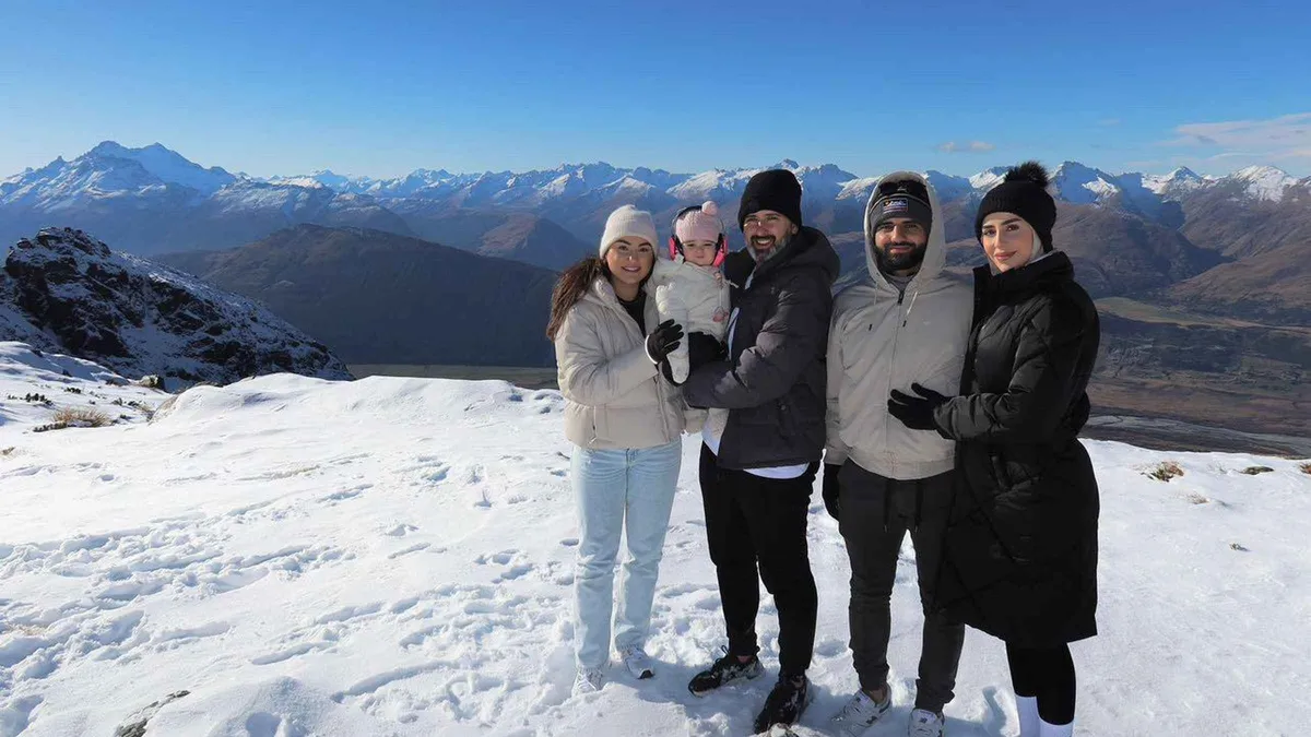 from $289.74
Queenstown Helicopter Flight with Snow Landing | 30 mins
Thirty minutes with an alpine snow landing, pitched at families and first-time flyers, flying from the Heliworks base at Frankton. Hotel pickup is an option rather than standard, so check what you booked.
Check Availability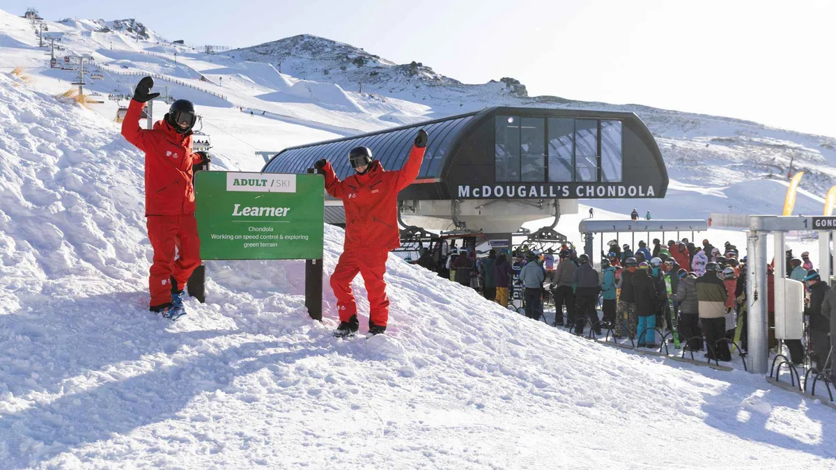 from $186.72
From Queenstown: Cardrona First Timer Ski or Snowboard
A learn-to-ski or snowboard day at Cardrona with the transfer from Queenstown, the skis or board, the outerwear, the learner pass and a full day of group lessons in one booking. Nothing to hire on arrival.
Check AvailabilityPrices, ratings and details are the platform's own, checked in Q3 2026; dollar figures are the listed prices — the platform bills in your account's currency.
The Range: What It Is, How High, and What It Is Called
Facts here come from the Department of Conservation's March 2025 Queenstown day walks and bike trails brochure and from the LINZ New Zealand Gazetteer, both read on in Q3 2026.
The range runs roughly north to south down the eastern side of Lake Wakatipu, and its western face is the wall in every photograph of Queenstown. It is schist, it holds cirques and small glacial lakes in its upper basins, and it is a conservation area rather than a park with a visitor centre. The high point is Double Cone.
DOC prints 2,307 metres beside it on the map in its own brochure, and it prints the same figure beside Mount Tuwhakaroria in the same panel. That is the number this page uses, and it is not the number most guides use.
Why we do not print 2,319 metres
The height in wide circulation is 2,319 metres. We could not find an official page that publishes it. The LINZ gazetteer entry for Double Cone carries the coordinate, at 45.07157 south and 168.80775 east, and records the name as unofficial, but it publishes no elevation at all. DOC's map is therefore the only authority we have, and DOC says 2,307 metres.
The gap is twelve metres and it changes nothing about the view. It is here because a figure no authority prints is a figure you cannot check.
The names, and the one that is missing
DOC records the traditional name of the range as Kawarau, the same name carried by the river to the north, and notes that it was a site of nohoanga, encampment, and mahinga kai, food and resource gathering, and is habitat for taonga species. That is the citable half of the naming question.
The English half is not. No DOC, LINZ or council page we read on in Q3 2026 explains where the English name came from. LINZ records The Remarkables as an official name in the Otago land district, but its detail page renders in a browser only and its interface returned an error to us, so the origin note was never obtained. The story you will hear, that a surveyor pronounced the range remarkable, is folklore repeated everywhere and sourced nowhere. We would rather say that than dress it up.
The film location that is not here
The range gets attached to The Lord of the Rings constantly. No official source we read connects the films to the range itself. What DOC does state is that Twelve Mile Delta, on the road towards Glenorchy, was the location for the Ithilien Camp, and that the Kawarau Suspension Bridge featured in the films.
If a film location is the reason for the trip, Glenorchy is the drive that delivers it.
Can You See The Remarkables From Queenstown?
Yes, and you will struggle not to. The wall faces the town across the Frankton arm of the lake, and the summit sits about 15 kilometres south-east of the town centre in a straight line, a distance we calculated from the LINZ coordinate for Double Cone rather than took from anyone.
The light is the thing worth planning. The face points roughly west, so it takes the last sun of the day while the town is already in shade, which is why every postcard of the range is an evening photograph. The Lake Wakatipu page covers the water in front of it, and Queenstown Gardens is the flattest walk with the view.
The Two NZSki Mountains Beside Queenstown, Side by Side
The published figures for both fields, from NZSki's own 2026 winter media kits, read on in Q3 2026. The pass price is deliberately absent: it is the same Superpass at both, so the comparison is terrain, snow and road, not money.
| Field | Peak and vertical | Skiable area | Average snowfall | Getting there |
|---|---|---|---|---|
| The Remarkables | 1,943 m peak, 468 m vertical | 385 hectares | 3.67 m a year, before snowmaking | 24 km, 45 min; final section gravel |
| Coronet Peak | 1,649 m peak, 462 m vertical | 280 hectares | 1.99 m a year, before snowmaking | 16 km, 20 min; sealed the whole way |
The short version: this mountain is higher, bigger and gets nearly twice the natural snow, and it makes you drive an extra 25 minutes with the last part on gravel. The other one is 20 minutes from town on a road the council clears first, and it is the one that runs night skiing. A first-timer with one ski day and a rental car usually wants the closer field; a confident skier with a week wants this one.
The Ski Area, and the Day Rate That Does Not Exist
Mountain statistics from NZSki's 2026 winter media kit for this field; the pass price confirmed on the operator's own shop page on in Q3 2026.
The field sits in three north-facing bowls under the summit ridge, with a terrain park carrying a Burton Stash. Terrain splits 30 per cent beginner, 40 intermediate, 30 advanced, a broader spread than the reputation suggests. The peak is 1,943 metres, the vertical drop 468 metres and the skiable area 385 hectares, with an average of 3.67 metres of natural snow a year and 158 automated guns for the seasons that do not deliver it.
The 2026 season is targeted at 13 June and anticipated to close on 11 October, the longest of the fields around this town. Both words are the operator's own hedges.
One pass, three mountains
There is no Remarkables day pass. NZSki sells the Superpass, and the same $105.10 (NZ$180) buys a day here, a day at the field across the valley or a day at Mt Hutt in Canterbury, with a further nine New Zealand fields included and the per-day rate falling as days are added. We confirmed the figure on the operator's own shop page in this run.
That structure is worth exploiting. If the forecast is marginal, buy days rather than a date, read the two snow reports at 06:30 and drive to whichever mountain has the better morning.
What is not published
No child, youth or senior day rate appears anywhere we could read. Every public pass page prints per adult and nothing else, and a family figure only surfaces once you are inside the booking flow. No individual ski-bus stop names or times are published either, only the phrase about central Queenstown before 09:00 and Frankton after 09:30.
And no page states a number of hairpins on the access road, despite the number appearing in half the blog posts about it.
The Access Road: Gravel, Chains and What the Operator Actually Says
Road rules quoted from NZSki's own guidance and its 2026 media kit; both were read on in Q3 2026, and the operator's site refuses automated reading, which is why the figures below were transcribed by hand.
The drive is 24 kilometres and about 45 minutes from Queenstown, of which the access road proper is the last 13. NZSki's media kit describes it as 9 kilometres sealed and 4 unsealed; its own Getting Here guide says sealed for the first 10 kilometres with the final section unsealed. The two disagree by a kilometre and agree on the part that matters: the top of this road is gravel, and it is gravel on a mountainside.
The operator's position on vehicles is more relaxed than the road's reputation: all vehicles are permitted and 4WD vehicles are not required. The qualifications are the important half. Depending on the vehicle you may need to fit chains, two-wheel-drive cars and high-sided vehicles such as campervans can be restricted in bad weather, and the standing rule is that chains must be carried at all times regardless of the weather in town.
| Way up | Cost | Time | The catch |
|---|---|---|---|
| Own car or rental | Fuel; parking at the base | About 45 minutes, 24 km | Carry chains always; check your rental agreement covers an unsealed alpine road |
| NZSki ski bus | $21.00 (NZ$36) return | Central Queenstown before 09:00, Frankton after 09:30 | No stop list or timetable is published; three new 4WD coaches ran in 2026 with a fourth mid-season |
| Helicopter, alpine landing | $179.11 listed | About 20 minutes in the air | Weather-dependent: cloud, wind or a landing site out of limits moves or cancels it |
| Summer drive, no skiing | Road toll, amount not published | Same road, same 45 minutes | DOC states a toll applies outside the ski season but publishes no figure, and the operator's pages did not answer |
The 06:30 rule
NZSki updates the snow report daily by 06:30 and tells drivers to read it before setting out. On a marginal morning that report is the whole decision, because a road closure here does not look like a road closure in town: the weather at lake level can be still and clear while the last four kilometres are drifted.
Check the rental agreement too: several New Zealand agreements exclude unsealed roads, and this road and Skippers Canyon are where that clause bites.
The Remarkables in Summer: One Track, and a Toll
In summer the ski field publishes nothing at all, which leaves visitors assuming the road is shut. It is not, and the walk at the top of it is the best short alpine outing near Queenstown.
The Lake Alta Track leaves the ski-area car park and climbs 2.4 kilometres return, about an hour and a half, to a glacial lake at 1,800 metres in a schist cirque. DOC's description is a track that climbs steadily with cairns and flagstones marking the way, following a ski-field road at first to the top of the Lake Alta chairlift, with information boards at the cirque. In winter the same route runs through an operational ski field and is usually under snow.
Two things a summer visitor should know before setting out. DOC states that a road toll applies outside the ski season and publishes no amount, so carry a card and expect a charge nobody can price for you in advance. And DOC's warning about this conservation area is unqualified: high winds and cold temperatures can be experienced at any time of the year, with snowshoes and poles recommended in winter, and the tracks are described as suitable in summer only even though snow may still be present.
Where it sits among the walks
Ninety minutes return at 1,800 metres is rare here: almost everything else at this altitude near Queenstown starts at lake level and climbs all day. The alpine plants are fragile and DOC asks walkers to tread with care and carry everything out. If the plan is a longer day on foot, Ben Lomond is the six to eight hour version and Queenstown Hill the two to three hour one, both on the Queenstown walks hub.
How Much Time to Give The Remarkables
Three routings with door-to-door times built from NZSki's 45-minute drive figure and DOC's published track time. What each one gives up is the column that decides it.
The mountain is far enough from town that none of these is a spare-hour decision. Budget a half day at the least, and in winter budget the morning weather check with it.
| Routing | Door to door | Cost | What it gives up |
|---|---|---|---|
| Summer drive and the Lake Alta Track | About 4 hours from town | Road toll, amount not published | Nothing on the mountain; you will want a second walk to fill the day |
| A full ski day | About 9 hours, including the road both ways | $105.10 (NZ$180) plus transport | The rest of the day in town, and any flexibility if the road closes |
| Helicopter, alpine landing | About 90 minutes from Frankton | $179.11 listed | The mountain itself: you land on a spur, you do not travel the range |
With one clear day, the flight is the honest recommendation for non-skiers and the ski day for skiers. The summer walk is the best value of the three and the one that depends most on a forecast, which the weather by month page sets out.
The Remarkables: What to Do and What Not To
Every line here is argued above; this is the version you use on the morning.
Do
- Carry chains for the ski road even when town is clear. That is the operator's standing instruction, not a weather-dependent one.
- Read the snow report before you leave; NZSki updates it by 06:30 and the last four kilometres decide the day.
- Buy pass days rather than dates so you can pick the mountain with the better morning.
- In summer, take the Lake Alta Track: 90 minutes return to a lake at 1,800 metres is the cheapest alpine hour near Queenstown.
- Check that your rental agreement allows unsealed roads before you commit to driving up.
Don't
- Do not print or plan around 2,319 metres as the summit height; DOC's own map says 2,307 metres and nothing official supports the higher figure.
- Do not expect a summer road toll you can budget: a toll applies and no authority publishes the amount.
- Do not repeat the surveyor story about the English name as fact; no official source states an origin.
- Do not assume a Lord of the Rings connection to this range; the citable locations are Twelve Mile Delta and the Kawarau bridge.
- Do not plan a family day from a published child price. There is not one on any public NZSki pass page.
Five Things Most Visitors Do Not Know About The Remarkables
- The height everyone quotes is not the height any authority publishes: DOC's own brochure map prints Double Cone at 2,307 metres, and the LINZ gazetteer entry carries a coordinate but no elevation at all (DOC Queenstown day walks and bike trails brochure, March 2025; LINZ New Zealand Gazetteer, feature 104783).
- The traditional name of the range is Kawarau, the same name as the river north of it, and the range was a site of nohoanga and mahinga kai (Department of Conservation, Remarkables Conservation Area).
- A road toll applies on the access road outside the ski season, and no authority publishes the amount (Department of Conservation, Remarkables Conservation Area).
- There is no day pass for this ski area alone: NZSki sells one Superpass valid at three of its own mountains and nine more New Zealand fields, which is why the price here matches the field across the valley (theremarkables.co.nz shop, lift pass, read on in Q3 2026).
- The operator says four-wheel drive is not required, and in the same breath says chains must be carried at all times regardless of the weather in town (NZSki, The Remarkables getting-here guidance and 2026 winter media kit).
- No page published by the operator or the council states how many hairpins the access road has, which is the number every blog post about the drive quotes (checked across NZSki and Queenstown Lakes District Council pages on in Q3 2026).
What a Closed Day Means Here
Two different things close here: the lifts and the road. The lifts stop for wind, and this ridge is exposed enough that a chair can be held while the sun is out. The road closes for snow, drifting or an incident, and it is the road that strands people.
A lift pass is bought for a day and the operator's own terms decide what happens to an unused one, so read them at the checkout rather than assuming a refund. The two booked products here publish something firmer: the beginner ski day cancels free up to 24 hours before the start, and the helicopter flight is explicitly weather-dependent, the operator rebooking or refunding under its own terms when cloud, wind or a landing site out of limits stops it.
- No operator in this valley publishes the wind speed or visibility at which it stops. We looked for a number on every page we could read and found judgement, not a threshold.
- The snow report at 06:30 is the only forecast that carries operational weight, and it is published before most visitors are awake.
- In summer the risk is not closure but exposure: DOC warns of high winds and cold at any time of year on this range and recommends snowshoes and poles in the winter months.
- If the mountain is out, the fallback is not another mountain in the same weather. Rainy day Queenstown is the page with the indoor half of the town.
The Remarkables on the Map
Double Cone at the LINZ coordinate, the town it faces, and the two places on this site that share the drive. The ski area itself publishes no coordinate.
Coordinates from the LINZ New Zealand Gazetteer. OpenStreetMap tiles.
What Is Next to the Range
Three places on the same side of the valley, with what each takes.
Lake Wakatipu
The water the range stands over, 80 kilometres long and over 300 metres deep for more than half its length. Lake Wakatipu has the boating rules and the cruises.
At the foot of the rangeFrankton
The ski bus picks up here after 09:30 and the airport sits beside it, which makes it the practical base for a ski week. Frankton has the detail.
On the way, 10 minutes from townThe field across the valley
Same pass, closer road, lower mountain, and the only night skiing in the country. The other NZSki field is the alternative on a bad-road morning.
45 minutes the other wayThe Remarkables Questions
What are The Remarkables in Queenstown?
A mountain range on the eastern side of Lake Wakatipu and, separately, a ski area on its western flank. The range is a Department of Conservation area whose high point, Double Cone, DOC prints at 2,307 metres; the ski field is one of three mountains NZSki sells on a single pass, priced above.
Can you see The Remarkables from Queenstown?
Yes. The wall faces the town across the Frankton arm, with the summit about 15 kilometres from the town centre in a straight line by our calculation from the LINZ coordinate. It takes the last light of the day, which is why the evening photographs work and the morning ones do not. The lakefront and the gardens are the easiest viewpoints.
Why is it called The Remarkables?
Nobody official says. DOC records the traditional name as Kawarau, the same name as the river to the north, but no DOC, LINZ or council page we read explains the English name. LINZ lists it as an official name without a retrievable origin note, so the surveyor anecdote you will hear repeated is folklore, and we print it as such.
How high is Double Cone?
2,307 metres on the map in DOC's own Queenstown day walks brochure, which is the only official figure we could find. The widely quoted 2,319 metres appears on no authority's page, and the LINZ gazetteer records the coordinate with no elevation at all.
How much is a lift pass for the ski area?
$105.10 (NZ$180) for a full adult day, which is the Superpass rather than a mountain ticket: the same pass covers this field, the one across the valley, Mt Hutt and nine more New Zealand fields, and the per-day rate falls as days are added. No child rate is published on any public page.
How do you get from Queenstown to the ski field?
24 kilometres and about 45 minutes by road, the last stretch of it gravel, with chains to be carried whatever the weather in town. Without a car, the operator's bus is $21.00 (NZ$36) return, leaving central Queenstown before 09:00 and Frankton after 09:30. Getting around Queenstown covers the town network, which does not serve the mountain.
Is there anything to do up there in summer?
Yes, though the ski field publishes nothing for the season. DOC's Lake Alta Track runs 2.4 kilometres return in about 90 minutes from the ski-area car park to a glacial lake at 1,800 metres, and DOC warns that a road toll applies outside the ski season without stating the amount. The summer section has the detail.
The Remarkables on Video
Three films that show the bowls, the access road and the view back over the lake, which is the part photographs flatten.
An Insider's Guide to The Remarkables (Part a-Background & On-Piste)
The bowls and the on-piste terrain, which is the fastest way to judge whether 385 hectares suits your week.
Video: SRG SkiingThe Remarkables Resort Guide | South Island | New Zealand
A run-through of the trail map and the base area, including where the beginner terrain sits.
Video: MTNhacksBreathtaking Queenstown Views from The Remarkables Ski Field
The view back down over the Wakatipu basin from the field, filmed on a clear day.
Video: Snowfall NZVideos load from YouTube only when you press play. None of them is ours and none is sponsored.
Reviewed Q3 2026 (July–September 2026); next review Q4 2026. Prices, hours and terms are set by the venue or operator and confirmed at checkout.
We may earn a commission if you book through one of our links, at no extra cost to you. Full affiliate disclosure