 Queenstown City Guide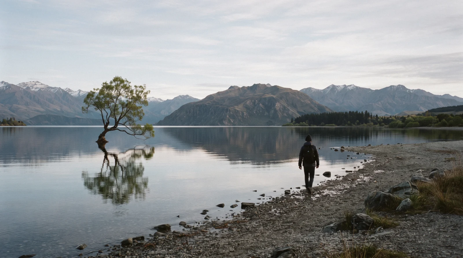
Wānaka from Queenstown
Wānaka from Queenstown is the day trip that looks simplest on a map and is the least documented in practice: not one of the 3 roading and conservation authorities we checked publishes a distance or a drive time between the two towns. We checked NZTA, the Queenstown Lakes District Council and the Department of Conservation, and what exists instead is a set of official fragments. The Crown Range summit sits 40 km south of Wānaka, the ski field partway up the valley is about an hour from Queenstown Airport, and the low route through the Kawarau Gorge can run an hour longer when the gorge is under works. This page builds the two routes out of those fragments, prints what DOC does and does not publish about Roys Peak, gives Puzzling World's own prices and hours, and says plainly that the country's most photographed tree has no official page anywhere. It sits under the day trips hub and inside the Queenstown city guide; the road over the pass is covered on the Cardrona page.
Quick answer The two routes, what is actually published, and what a day there costs
Wānaka is a day trip by road only, over the Crown Range or round through the Kawarau Gorge and Cromwell, and no roading authority publishes a drive time for either. The nearest official anchors are the ski field's own two legs, about an hour from Queenstown Airport and 45 minutes from Wānaka, which put the pass route somewhere under two hours each way. Everything in the town is free except Puzzling World, whose combo ticket is $18.98 (NZ$32.50) for an adult; a bare dollar sign on this site means United States dollars, converted at NZ$1 = $0.584.
Key takeaways
- Take the pass out and the gorge back if the forecast allows it: the two routes are compared line by line in the routes table, and the pass is the one that closes for snow.
- Roys Peak is the walk people come for and the one most often misdescribed, because DOC publishes no distance and no walking time for it, only over 1,200 m of climbing to a 1,578 m summit.
- Spring travellers lose it entirely: the lambing closure runs 1 October to 10 November, which is the middle of the New Zealand spring travel season.
- If the weather turns, Puzzling World is the indoor answer at $18.98 (NZ$32.50) for the combo, and the only seat you can book from Queenstown over the same pass is the Cardrona learner day.
Key facts
Opening hours
| The town, the lakefront and the walks, all year | 00:00–23:59 |
|---|---|
| Puzzling World, daily (last admission 16:30) | 09:00–17:00 |
| Rippon cellar door, daily, bookings required | 12:00–17:00 |
Closed None for the town. Puzzling World is closed on Christmas Day; Roys Peak Track is closed for lambing from 1 October to 10 November; the Crown Range route closes for snow and for roadworks without a published calendar
Admission
- Adult
- Free to visit. The priced attractions we could source: Puzzling World combo $18.98 (NZ$32.50) adult, illusion rooms alone $15.48 (NZ$26.50), the maze alone $12.85 (NZ$22)
- Reduced
- Puzzling World child, ages 5 to 15, $13.72 (NZ$23.50) combo; senior 65 and over $16.64 (NZ$28.50); family of two adults and two children $57.80 (NZ$99)
- Free
- Under 5s at Puzzling World, the lakefront, the tree everyone photographs, Roys Peak Track and its car park, and the Crown Range itself, which is a public road with no toll
Planning it
- Time needed
- Not stated by any authority. Our routing: 8 hours door to door for the lakefront and one short walk, 11 hours if Roys Peak is the reason you are going
- Book ahead
- Optional — walk-up usually fine
- Address
- Wānaka, Otago, at the southern end of Lake Wānaka; Puzzling World is on the Wānaka–Luggate Highway east of town, Rippon at 246 Wanaka Mount Aspiring Road, the Roys Peak car park about 6 km west of town on the same road
What costs money in Wānaka, and what does not
Every priced thing we could source in Wānaka, read from the operators' own websites on in Q3 2026, next to the free ones that fill most of the day. Prices on this site are United States dollars first with New Zealand dollars in brackets at NZ$1 = $0.584. Every row here is an official operator page and none of the links carries a tracking parameter.
Are you buying a ticket, or buying a day? Nothing in Wānaka charges for the view, so the only question is whether the weather sends you indoors and whether you want a cellar door booked before you leave Queenstown.
| What | Price | Hours and terms | The catch | Book |
|---|---|---|---|---|
| Puzzling World combo, illusion rooms and the mazeAnyone travelling with children, and anyone whose day has been rained out | Adult $18.98 (NZ$32.50), child $13.72 (NZ$23.50), senior $16.64 (NZ$28.50), family of four $57.80 (NZ$99) | Open daily from 09:00, last admission 16:30, closed Christmas Day; the operator states these prices are valid to 31 March 2027 | Child means 5 to 15 and under-5s are free, so a family with a toddler pays less than the family rate suggests | Official site |
| Puzzling World, one half onlyAdults with two hours rather than four, or a family that wants only the maze | Illusion rooms $15.48 (NZ$26.50) adult; the Great Maze $12.85 (NZ$22) adult | Same hours; each is sold separately at the door | The maze alone can absorb an hour with a competitive teenager and nothing else | Official site |
| Rippon cellar door, above the lakeWine travellers who will phone ahead; the walk-in crowd is not catered for | Tasting fee not stated; Rippon publishes no price on its site | Daily 12:00 to 17:00 as posted in the week we read it, and the banner says bookings are required | The hours line is rewritten week by week, so treat 12 to 5 as this week's rather than a standing schedule | Official site |
| Roys Peak Track and its car parkFit walkers with a full day and an early alarm. Nobody else | Free, and DOC states parking is free for cars and campervans | Open all year except the lambing closure, 1 October to 10 November | DOC grades it challenging, warns of avalanche terrain above 1,000 m, and publishes neither a distance nor a time | Official site |
| The lakefront, the town and the treeEveryone. This is what the day is actually made of | Free | No gate, no hours, no season | Also no official information: no authority publishes anything at all about the tree in the lake | Official site |
Puzzling World and Rippon publish their own figures and we have used them as printed. DOC publishes the Roys Peak closure and the hazards but not the walk's length, and the council publishes nothing about the tree. Where a figure is missing on this page, it is missing because nobody publishes it, not because we did not look.
The one seat you can book from Queenstown over the pass
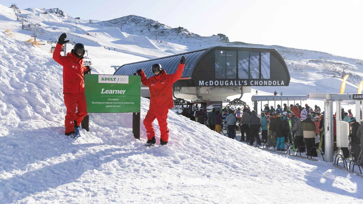
There is no Queenstown-to-Wānaka day tour on the platform this site compares: the operators sell the mountain, not the town. The single seat that crosses the Crown Range from a Queenstown hotel is the learner day at the ski field partway up it, which stops 35 km short of Wānaka and is a winter product only. Its rating, duration and price are GetYourGuide's own, read on in Q3 2026.
 from $186.72
From Queenstown: Cardrona First Timer Ski or Snowboard
A learn-to-ski or snowboard day at Cardrona with the transfer from Queenstown, the skis or board, the outerwear, the learner pass and a full day of group lessons in one booking. Nothing to hire on arrival.
Check AvailabilityIf you want Wānaka itself rather than the snow, the honest answer is a rental car or the scheduled coach; what the drive involves is set out below, and the ski day has its own page with the resort's full price list.
Prices, ratings and details are the platform's own, checked in Q3 2026; dollar figures are the listed prices — the platform bills in your account's currency.
The two routes to Wānaka, and the drive time nobody publishes
This is the fact that surprises people who look it up properly: NZTA, the Queenstown Lakes District Council and DOC were all checked, and not one of them publishes a Queenstown to Wānaka distance or a door-to-door time.
What the authorities do publish are pieces of the journey. DOC states that the Crown Range summit car park is 40 km south of Wānaka on the Cardrona Valley and Crown Range Road. The ski field partway up that valley publishes its own two legs: about an hour from Queenstown Airport, 54 km, and 45 minutes from Wānaka, 35 km.
The council publishes the consequence rather than the distance on the alternative, warning that with worksite conditions in the Kawarau Gorge it 'could take up to an hour longer to complete your journey between Wānaka and Queenstown'. Add the resort's two legs and you are under two hours over the pass, which is arithmetic on an operator's figures rather than a published drive time, and this page will not pretend otherwise.
| Route | What is officially published | When it closes | Take it if |
|---|---|---|---|
| Crown Range Road, over the pass | Summit about 1,076 m (NZTA); 40 km from the summit car park to Wānaka (DOC); free public road, no toll | Snow in winter, and roadworks: the council has closed it for a week of daytime slip clearance and for 45-minute rockfall-fencing closures in recent seasons | The forecast is clear and you want the drive to be the point of the day |
| State Highway 6, the Kawarau Gorge and Cromwell | No distance or time published by any roading authority; the council warns the gorge under works can add up to an hour | Rarely; it is the low-level, all-weather fallback | It is snowing, you are in a campervan, or you are towing anything |
| Pass out, gorge back | Both of the above; the two roads meet again at each end | Whichever half is closed on the day | You have the daylight and want two different landscapes for the same fuel |
| The scheduled coach | Not published in our sources: we could not source a fare or a timetable from a carrier's own site | Not stated | You have no licence; buy direct from the carrier and check the return time before you commit |
The correction worth carrying: it is not the highest sealed road
Almost every page about this drive calls the Crown Range 'New Zealand's highest sealed road'. NZTA, which is the road authority, does not say that. Its own wording is that the highest sealed local road pass is the Crown Range Road in Central Otago between Queenstown and Wānaka at about 1,076 metres, and in the same answer it names a higher sealed public road: SH48, the Bruce Road up to Whakapapa Village in the central North Island, at approximately 1,153 metres.
Two words carry the whole difference, 'local' and 'pass'. DOC, describing the car park at the top rather than the road, gives 1,100 m, so if you see both numbers quoted they are measuring different things. The full account of the road, its winter maintenance and what the council does not publish about chains is on the Cardrona page.
Fuel, coverage and the gorge
Both routes pass through settlements with fuel, which is not true of every day trip from Queenstown, and the gorge route runs past Gibbston on the way. That is worth planning around rather than stumbling into: the wineries on that stretch have their own page at Gibbston Valley, and the bridge in the gorge is the one with the bungy on it, covered on the Kawarau bungy page. One caution on the gorge itself: the small power station at the Roaring Meg was commissioned in 1936 according to Te Ara, the government's encyclopedia, but that page refused every attempt to read it directly on the day we checked, so we print it as attributed rather than verified.
The origin of the name is not stated by any official source at all, whatever the roadside stories say.
How much time to give Wānaka
Three routings, built from the official fragments above and the operators' own hours, with the door-to-door figure a Queenstown bed actually sees.
There is no published visit length for Wānaka because there is no gate to publish one. What sets the length is the walk you choose and the daylight left after the driving, and the two are in direct competition. A lakefront day is comfortable and gets you back for dinner in Queenstown.
A Roys Peak day is not a day trip with a walk in it; it is a walk with a drive at each end.
| Routing | In Wānaka | What it skips | Door to door from Queenstown |
|---|---|---|---|
| Lakefront, the tree, lunch, one short walk | About 5 hours | Roys Peak, and any cellar door you have not booked | About 8 hours |
| Add Puzzling World or a booked tasting | About 6 hours | The long walk, still | About 9 hours |
| Roys Peak as the reason for the trip | About 7 hours, most of it climbing | Everything else; you will see the town from above and from the car park | About 11 hours, leaving Queenstown before dawn |
Those three lines are our routing, not an official figure, and they exist because no authority publishes one. The inputs that are official: DOC's 40 km from the Crown Range summit to Wānaka, the resort's hour from the airport, Puzzling World's 09:00 opening and 16:30 last admission, and Rippon's posted 12:00 to 17:00. If your day is shorter than eight hours, Wānaka is a drive rather than a visit, and the shorter day trips will use the time better.
If you have two days rather than one, the case for sleeping there instead is real and it is argued on where to stay in Queenstown, which sets out what staying in the Queenstown basin buys you and what it does not.
The season changes the arithmetic more than the map does
In December there is light until well after 21:00 and an eleven-hour day is comfortable. In June the same eleven hours do not exist: the pass is the road most likely to be gritted rather than clear, and a walk that starts in the dark ends in the dark. The month-by-month shape of it is on Queenstown weather by month, and the winter version of every plan on this page is on Queenstown in winter.
Roys Peak: what DOC publishes, and what it does not
The photograph on the ridge has made this the best-known walk in the district, and the figures attached to it online come from nowhere official. Here is the difference between the two.
The Department of Conservation's track page publishes an elevation gain of over 1,200 metres to a 1,578-metre summit, grades the walk challenging, and says high fitness is needed. It publishes no distance and no walking time. The '16 km return, five to six hours' that appears on almost every blog and aggregator is therefore not DOC's figure and has no authority behind it; it may well be about right, and it is still someone's estimate repeated until it looked official.
On a track with 1,200 metres of climbing and no water, the gain is the number that matters anyway: it is the one that tells you what your legs are being asked to do.
| What people quote | What DOC actually publishes | Why the difference matters |
|---|---|---|
| 16 km return | No distance stated on the track page | You cannot pace a walk on a number nobody stands behind |
| 5 to 6 hours return | No time stated on the track page | Plan by daylight and by the gain, not by a borrowed figure |
| 'Easy but long' | Challenging; high fitness needed | DOC's grading is the only official difficulty rating there is |
| The viewpoint is most of the way up | No separate viewpoint distance or turnaround time published | The famous ridge is not the summit, and DOC does not tell you where it is |
| Open all year | Closed 1 October to 10 November for lambing | Six weeks of peak spring travel, and the gate is shut |
The lambing closure is the trip-ruiner
The track crosses private farmland and DOC states plainly that it is closed from 1 October to 10 November. That window sits in the middle of the southern spring, when the weather has turned and the summer crowds have not arrived, which is exactly when an experienced traveller would choose to walk it. There is no ticket to refund and no notice at the Queenstown end of the drive: if you arrive in that window, you have driven for the better part of two hours to read a sign.
Check before you leave, and if you are in that window, put the day into something that does not close, such as the Ben Lomond track above Queenstown or the walks hub.
The hazards DOC does publish
For a walk with no published length, the hazard list is unusually specific: challenging avalanche terrain above 1,000 metres, snow and ice through winter and early spring, mud, an alpine environment subject to sudden change in any month, no shade and no water anywhere on the route, and mountain bikes prohibited. The car park sits about 6 km west of town on the Wānaka–Mount Aspiring Road, parking is free for cars and campervans, and DOC's own warning is that it 'gets very busy and there may not be parking spaces available'. Nothing about this walk rewards a late start.
That Wānaka Tree: the most photographed tree in the country has no official page
This is the strangest gap we found on this site, and it is worth stating rather than papering over.
We searched the council, the Department of Conservation, Land Information New Zealand and the Otago Regional Council for anything at all about the willow standing in the lake at the western end of the Wānaka lakefront. There is nothing: no species record, no protection status, no location page, no visitor guidance, no official name. The council's tree pages cover its own removal requests and a succession plan for different trees at Eely Point; the regional council's willow pages are about controlling willows across Otago in general.
Everything you have read about the tree's age, its species, its health and the best hour to photograph it is unattributed, which is why none of it appears on this page.
What can be said honestly is short. It stands in the water off a public lakefront, nobody charges anything to look at it, and the walk to it from the town centre is flat. It has a Wikidata entry of its own, which is how the internet records a thing that officialdom has not, and no more than that.
If a page tells you it is 'over a hundred years old' or 'a crack willow planted as a fence post', ask which authority said so; we could not find one, and we looked at four.
What that means for your photograph
Practically: it is a lake-level subject facing across open water, so the light is the variable, not the access. Nothing is closed, nothing is booked and nothing is charged, so it costs you the twenty minutes it takes to walk there and back. It is also, by a distance, the most crowded twenty square metres in Wānaka in summer, and the crowd is the one detail every photograph leaves out.
Puzzling World, the answer when the weather beats you
The one attraction in town that publishes prices, hours and its own coordinates, and the reason a wet forecast does not have to cancel the drive.
Puzzling World sits on the highway just east of town and is open every day from 09:00 with a last admission at 16:30, closed only on Christmas Day. It sells its two halves separately or together, and it publishes something almost nothing else in this district does: an expiry on its own price list, stating that its admission prices are valid to 31 March 2027. Child means 5 to 15, under-5s are free, and senior means 65 and over.
| Ticket | Adult | Child, 5 to 15 | Senior, 65 and over |
|---|---|---|---|
| Combo, illusion rooms and the maze | $18.98 (NZ$32.50) | $13.72 (NZ$23.50) | $16.64 (NZ$28.50) |
| Illusion rooms only | $15.48 (NZ$26.50) | $11.68 (NZ$20) | $13.72 (NZ$23.50) |
| The Great Maze only | $12.85 (NZ$22) | $10.51 (NZ$18) | $11.68 (NZ$20) |
| Family combo, two adults and two children | $57.80 (NZ$99) | Included | Not applicable |
The family rate is the one to check against your own maths: two adults and two children on the combo cost $57.80 (NZ$99), while the same four bought singly come to $65.40 (NZ$112). With a child under five in the group, the under-fives are free and the family rate stops being the cheaper option. Nothing here is timed and nothing needs booking; you turn up.
Ninety minutes covers the illusion rooms comfortably, and the maze takes as long as the most stubborn person in your group makes it take.
The lakefront, the cellar door and what the day is actually made of
Wānaka's argument against Queenstown is not that it has more to do. It is that it has less, in a good order.
The town sits at the southern end of Lake Wānaka at the start of the Clutha River and is the gateway to Mount Aspiring National Park, which is the sober description and also the accurate one. A day here is a flat lakefront walk, a swim in season, lunch, and a decision about whether to climb something. That is the whole shape of it, and the reason people who prefer Wānaka to Queenstown prefer it: nothing on the waterfront is trying to sell you a seat.
Rippon: booked, or not at all
The cellar door above the lake at 246 Wanaka Mount Aspiring Road posts its hours a week at a time, and the banner on the day we read it said openly: open this week, bookings required. Rippon publishes no tasting fee anywhere on its site, so we print none. Phone ahead on 03 443 8084 rather than driving out on the assumption that a 12:00 to 17:00 line will still be there next month.
The comparable wine day nearer Queenstown, with prices we could source, is Gibbston Valley.
Where the walks are, if Roys Peak is out
The lakefront path needs no planning at all and the tree is on it. Beyond that, our walk pages are for Queenstown rather than Wānaka, so the honest routing is to keep the long climb for the Queenstown side, where DOC does publish times and distances, and use the Wānaka day for the flat. Queenstown walks has the full set with their published figures, and Queenstown Hill is the two-hour version of the Roys Peak instinct without the drive.
Weather, snow and what actually goes wrong on this day
The honesty layer for a drive that people treat as guaranteed because it looks short on a map.
Three things go wrong, in this order of likelihood. The pass is closed or slow: the council lists the Crown Range among its Priority 1 roads, kept open and gritted when necessary between 07:00 and 22:00, with snow clearance starting as soon as snow has settled, which is a maintenance commitment rather than a promise that the road is open at 08:00 on a snowy morning. The gorge alternative is under works: the council has warned that this can add up to an hour to a Wānaka to Queenstown journey.
Or the walk is closed: lambing shuts Roys Peak for six weeks whatever the sky is doing.
The gap we could not close is chains. The council's winter road report page, which is where its chain-carrying rule and its closure triggers for this road live, is behind a bot check and refused every attempt to read it on the day we checked, so this page publishes no chain rule for the Crown Range rather than a guessed one. What is published, and what we can print, is the ski operator's blanket advice for the access roads on the Queenstown side: carry chains at all times in winter regardless of the weather in town.
Rental agreements are the other half of this, and they are contracts rather than regulations: many exclude damage caused by fitting chains, or by not fitting them, so read yours before you assume you are covered.
If the forecast is bad the day before
Take the gorge in both directions and treat the drive as the scenic part, or move the trip and spend the day in town: Queenstown on a rainy day has the indoor options that do not involve two hours of driving to reach an indoor option. What you should not do is commit to the pass in a snow warning because the weather in Queenstown looks fine; the summit is a kilometre higher than the town.
Wānaka from Queenstown: what to do and what to avoid
Six decisions you can make the night before, each of them argued somewhere above.
Do this
- Check the lambing dates before you plan around Roys Peak; the closure runs 1 October to 10 November
- Leave before dawn if the peak is the point, and before 08:00 in any case for a car park DOC calls very busy
- Take the pass one way and the gorge the other when the forecast allows both
- Phone Rippon before you drive out; the cellar door's own banner says bookings are required
- Carry chains in winter and read the rental agreement's clause about them before you leave the depot
- Keep Puzzling World in reserve as the wet-weather half of the day rather than the whole of it
Not this
- Do not plan Roys Peak on a quoted 16 km or five hours; DOC publishes neither figure
- Do not take the pass in a campervan in snow, or towing anything at all
- Do not treat a clear Queenstown morning as a forecast for a summit at about 1,076 m
- Do not repeat that this is New Zealand's highest sealed road; NZTA names a higher one
- Do not expect official guidance about the tree in the lake; four agencies publish none
- Do not leave the return until dark in winter, when the gritting window ends at 22:00
Every item comes from the Department of Conservation's Wānaka area and Roys Peak pages, NZTA's state highway FAQ, the council's winter maintenance service levels and the operators' own sites, read on in Q3 2026.
Five things most visitors do not know about the Wānaka day trip
- No roading authority in New Zealand publishes a Queenstown to Wānaka distance or drive time; every figure online is a mapping-app output rather than an official one (NZTA, Queenstown Lakes District Council and the Department of Conservation, all checked on the date in the freshness box).
- The Crown Range is not the country's highest sealed road: NZTA calls it the highest sealed local road pass, at about 1,076 metres, and names SH48 Bruce Road at approximately 1,153 metres as higher (NZTA state highway FAQ).
- DOC publishes no distance and no walking time for Roys Peak, only an elevation gain of over 1,200 metres to a 1,578-metre summit (Department of Conservation, Roys Peak Track page).
- Roys Peak closes for lambing from 1 October to 10 November, in the middle of the spring travel season (Department of Conservation).
- No authority publishes anything about That Wānaka Tree: not the council, not DOC, not Land Information New Zealand, not the regional council (searches restricted to those four domains on the date in the freshness box).
Wānaka on a map: the town, the walk and the road over the pass
Where the four points that shape this day actually sit. The town point is the published coordinate for Wānaka, Puzzling World publishes its own, the Roys Peak pin is the summit rather than the car park, and the Crown Range pin is the range rather than the road summit.
Coordinates: Wānaka and the Crown Range from their published points, Puzzling World from its own website, Roys Peak from the Land Information New Zealand gazetteer entry for the summit. No authority publishes a coordinate for the tree, or for the Roys Peak car park.
What pairs with a Wānaka day, and what does not
Nothing pairs with it on the same day; the driving uses the day up. These are the trips for the days either side, and the road you will already have driven.
Cardrona Alpine Resort
The ski field partway up the valley you drive through, and the reason the pass has traffic in July. The Cardrona page has the resort's own prices, the sightseeing ride for non-skiers and the full account of the road.
On the road between the two townsAoraki / Mount Cook
If Wānaka has whetted the appetite for big mountains, the Aoraki day is three and a half hours each way and the walk at the end of it is flat. It does not fit the same day as this one.
The other long northern day, and a much longer oneDay trips from Queenstown
Milford Sound, Glenorchy, Arrowtown and the rest, with the drive times that decide which of them fit the days you have. The day trips hub compares them side by side.
Everything else, ranked by how long it takesWānaka from Queenstown: questions
Is Wānaka a day trip from Queenstown?
Yes, and it is one of the easier ones, but it is a full day rather than an afternoon. Nobody publishes a drive time: the closest official anchors are the ski field's own legs of about an hour from Queenstown Airport and 45 minutes from Wānaka, which put the pass route under two hours each way. Allow eight hours door to door for the lakefront and a short walk, eleven if you are climbing, as the routings show. If a long walk is the point, check the lambing dates first.
How long does the drive from Queenstown to Wānaka take?
No roading authority publishes it. We checked NZTA, the district council and DOC, and what exists is fragments: DOC's 40 km from the Crown Range summit car park down to Wānaka, the resort's hour from the airport and 45 minutes from the other end, and the council's warning that the gorge under works can add an hour. Everything else you have read is a mapping-app estimate presented as a fact. The routes table sets out what is actually published for each way round.
Which route should you take, the pass or the gorge through Cromwell?
The pass, unless the weather or your vehicle says otherwise. It is shorter and it is the drive people remember, and the summit is about 1,076 metres, which is why it closes for snow and why the council keeps it on its Priority 1 gritting list between 07:00 and 22:00. Take the low route through the gorge and Cromwell if it is snowing, if you are in a campervan or towing, or if you simply want to pass the Gibbston wineries on the way. Doing one each way is the best version of the day.
How hard is Roys Peak, and how long does it take?
DOC grades it challenging and says high fitness is needed, publishes an elevation gain of over 1,200 metres to a 1,578-metre summit, and publishes no distance and no time at all. The widely repeated 16 km and five to six hours are not DOC's figures. It has no shade and no water, DOC describes challenging avalanche terrain above 1,000 metres, and mountain bikes are banned. Treat it as a full day on its own, as set out above, or take a Queenstown walk with published figures instead.
When is Roys Peak Track closed?
From 1 October to 10 November, every year, for lambing. The track crosses private farmland and DOC states the closure plainly. It lands squarely in the southern spring, which is when many visitors would otherwise pick it, and there is no sign at the Queenstown end of the drive to save you. If you are travelling in that window, Ben Lomond above Queenstown is the substitute with a published time.
Is there anything to do in Wānaka if it rains?
Puzzling World, and it is a genuinely good answer rather than a consolation. It is open daily from 09:00 with a last admission at 16:30, closed only on Christmas Day, and the combo ticket is $18.98 (NZ$32.50) for an adult, $13.72 (NZ$23.50) for a child aged 5 to 15, with under-5s free. The full price list is above. If the pass is snowbound as well as wet, the better call is to stay in town: Queenstown on a rainy day has the options that do not need two hours of driving.
Can you get to Wānaka without a car?
Scheduled coaches run between the two towns and the search data shows plenty of people looking for the timetable, but we could not source a fare or a departure time from a carrier's own website in this round, so this page publishes neither rather than a figure copied from an aggregator. Buy direct from the carrier and check the last return of the day before you commit to a walk. The only seat we can price that crosses the same pass from a Queenstown hotel is the learner ski day, and it stops 35 km short of the town.
Is That Wānaka Tree worth the walk?
It is a flat twenty-minute walk from the town centre along a free public lakefront, so the cost of finding out is small. What we will not do is print the age, the species or the 'best time' that other pages give it: no authority publishes anything at all about it, as set out above, and everything circulating is unattributed. Expect company in summer, and expect the crowd to be the part the photographs leave out.
Our verdict: who should make this drive
Anyone with a car, a clear forecast and a full day should go, take the pass out and the gorge back, and treat the lakefront rather than the summit as the point. It is the day trip from Queenstown with the least driving per unit of landscape, and it is the one that shows you what the district looks like when it is not selling anything. Book nothing except a cellar door, and only if you want one.
Do not make this drive for Roys Peak between 1 October and 10 November, in snow without chains and a rental agreement you have read, or on a day that has to be back in Queenstown by mid-afternoon. And if the snow is the reason you are heading that way at all, the seat and the prices are on the Cardrona page rather than here, because the resort is the one bookable thing on this road. The day trips hub has the alternatives for the morning the pass is shut.
Wānaka on Film: the Town, the Lake and the Two Days
Three films that show what the day looks like from the ground: the town at walking pace, a two-day version of it, and the road trip that most people actually drive.
48 hours in WANAKA - Our Top Things To Do! (New Zealand Travel)
The two-day version of this page, useful for seeing what a day trip has to leave out.
Video: CJ ExploresWanaka town tour in real time New Zealand 2026
The lakefront and the town centre walked at real speed, which is how long the flat part actually takes.
Video: Steven RussellWANAKA & TEKAPO VLOG | Dreamy New Zealand Road Trip, Lake Views, Mt Cook & Cute Café Stops
The wider road trip, for anyone weighing Wānaka against the longer northern day.
Video: Jessie KateVideos load from YouTube only when you press play.
Reviewed Q3 2026 (July–September 2026); next review Q4 2026. Prices, hours and terms are set by the venue or operator and confirmed at checkout.
We may earn a commission if you book through one of our links, at no extra cost to you. Full affiliate disclosure