 Queenstown City Guide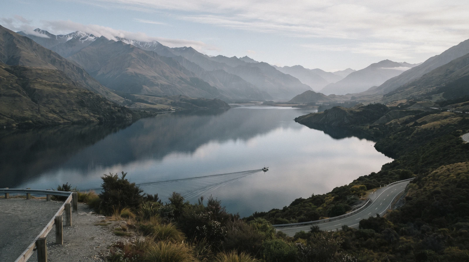
Lake Wakatipu: How Big, How Cold, and How to Get Out on It
Lake Wakatipu, Whakatipu Waimāori, is the reason Queenstown is where it is and looks how it looks: 80 kilometres of water bent into a dogleg between mountain ranges, deep enough that its floor lies below sea level, and cold enough all year that the council's own boating guide prints the temperature as a warning rather than a statistic. This page is about the lake as a place rather than as a backdrop. It sets out the figures and names which authority publishes each one, because they do not agree; it tells the Māori account of how the shape came to be; it takes the famous claim that the lake breathes and shows why nobody can currently source a number for it; and it lists every way of getting onto the water, each linked to the page or the card that owns it. It sits inside the Queenstown, New Zealand guide this page belongs to beside the things to do hub.
Quick answer Its size, its temperature, the rules that apply to you, and the ways out onto it
Lake Wakatipu is 80 kilometres long and covers 293 km², which makes it New Zealand's longest lake and its third largest by area, and the Queenstown Lakes District Council's own boating guide records that it averages 300 metres deep for over half its length and that its temperature ranges from 8 °C to 10 °C. That last figure is the one that matters most to a visitor: this is not a swimming lake dressed as one, it is cold-shock water all year. Prices on this site are US dollars first with the New Zealand dollar in brackets, at NZ$1 = $0.584.
Key takeaways
- Lifejackets are compulsory, not advisory, on every recreational vessel six metres and under including kayaks, and paddleboarders must wear a lifejacket or a full wetsuit at all times, which the rules section sets out in the council's own words.
- The cheapest way out onto the water is a floating sauna session at $38.05; the guided paddle to an island nobody else can land on is the kayak trip at $108.29.
- The 1912 coal-fired steamer is the lake's most-booked crossing and has its own page: the TSS Earnslaw, from $69.65 for a ninety-minute return.
- The famous claim that the lake breathes on a five-minute cycle is not supported by any source we could read, and three different figures are in circulation with no authority behind any of them.
Key facts
Opening hours
| The lake, all year | Always open–No gate, no closing time and no access charge |
|---|---|
| The 5-knot zone within 200 metres of shore | All year–Enforced under the QLDC Navigation Safety Bylaw and the Maritime Transport Act 1994 |
Closed None. The lake never closes; the boats on it stop for wind rather than for a calendar
Admission
- Adult
- Free. There is no access charge, no permit and no launching fee published for recreational use of the lake
- Reduced
- —
- Free
- Everyone, on the shore and in the water. What costs money is a seat on something: from $38.05 for a floating sauna session to $108.29 for a guided kayak trip
Planning it
- Time needed
- Twenty minutes on the town beach, two and a half hours for a guided paddle, or a whole day if you drive the shore road to Glenorchy
- Book ahead
- Optional — walk-up usually fine
- Address
- Otago, South Island, New Zealand; Queenstown sits on the northern shore near the eastern end of the middle section, and the Frankton Arm is the lake's only arm
Every way of getting onto Lake Wakatipu from Queenstown, priced from the council's own recreation pages and the platform listings on in Q3 2026. The council's boating page is the first row and its link carries no tracking. Prices are US dollars first with the New Zealand dollar in brackets, at NZ$1 = $0.584.
Do you want to be on the water, or on the water and going somewhere? The lake charges nothing and the shore is free; every figure below buys a seat on something, and half of them are transport rather than tours.
| Way onto the water | Price | How long | What it settles | Book |
|---|---|---|---|---|
| Your own kayak, paddleboard or swim from the shoreAnyone with their own craft, and anyone hiring one in town, since the same bylaw applies to a hired paddleboard as to a private boat | Free | As long as you like | No permit, no fee and no launching charge; the compulsory lifejacket rules apply from the moment you are underway | Official site |
| The 1912 steamer, booked direct with the operatorAnyone who wants the crossing and the engine room rather than a photograph of the boat from the pier | Operator's own fares; the platform listing below is the comparison | 1 hour 30 minutes return, or 3 hours 30 with the farm | The only scheduled passenger vessel that crosses the lake rather than circling the bay | Official site |
| Guided sea kayak to Pigeon or Pig IslandAnyone who wants the water at eye level rather than from a deck, and does not mind a lifejacket being compulsory | $108.29 | 2 hours 30 minutes, with transfer | The only trip with exclusive landing rights on those islands, in double sea kayaks with a coach transfer included | Check Availability |
| TSS Earnslaw ninety-minute lake cruiseFamilies and anyone short of a half day; the shortest way to be properly out on the lake rather than beside it | $69.65 | 1 hour 30 minutes | A return crossing on a coal-fired steamer with the engine room open to walk through | Check Availability |
| Floating sauna moored off the town shoreAnyone curious about the temperature who would rather approach it with a hot room to return to | $38.05 | 1 hour 15 minutes | A sauna barge with a cold plunge straight into the 8 to 10 °C water, which is the honest way to meet this lake | Check Availability |
There is nothing to buy to be on the lake itself, and no authority sells access to it, so the official row above is a rules page rather than a shop. The steamer's own fares live with its operator and are compared against the platform listings on the TSS Earnslaw page; the passenger ferry across to the peninsula is public transport rather than a tour and is priced on the Kelvin Heights page. Every craft on this list, including the hired paddleboard, sits under the council's Navigation Safety Bylaw.
The Bookable Trip That Belongs to the Lake Itself
One card lives on this page rather than on a page of its own, because it is the only listing sold as a trip onto the open lake rather than as a crossing to a destination. Price is the platform listing in US dollars read on in Q3 2026, and the card opens the operator's own calendar.
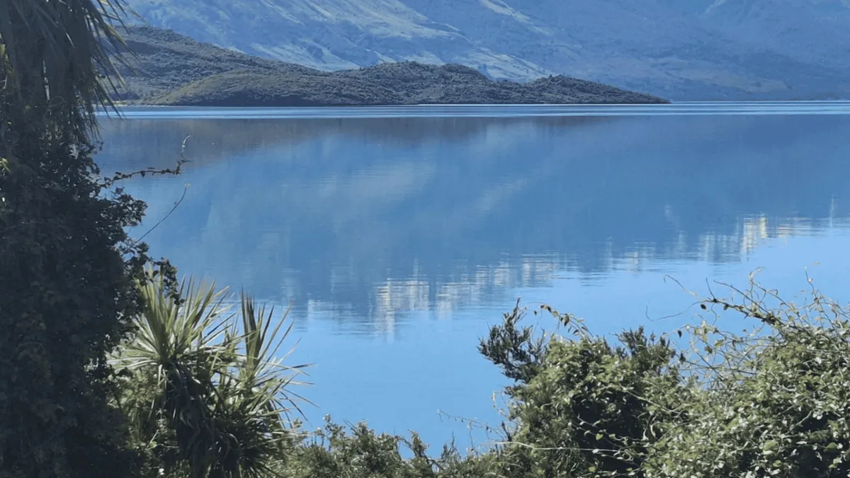 from $108.29
From Queenstown: Kayak Tour in Lake Wakatipu with pickup
A guided paddle to Pigeon or Pig Island, which this operator has exclusive landing rights to, with a short walk ashore and refreshments on a beach nobody else uses. Two and a half hours in double sea kayaks.
Check AvailabilityEverything else that floats has its own home: the steamer and Walter Peak, the ferry to Kelvin Heights, and the floating sauna moored off the Gardens shoreline, which sits on the Queenstown Gardens page.
Prices, ratings and details are the platform's own, checked in Q3 2026; dollar figures are the listed prices — the platform bills in your account's currency.
The Lake by the Numbers, and Who Publishes Each One
Chasing these figures to an authority turned out to be the most interesting work on this page, because two of the sources that ought to agree do not, and one negative finding in our own research notes turned out to be wrong.
Our first pass at the research recorded that no official New Zealand source publishes the lake's length, depth, area or water temperature. That was wrong, and the correction is worth printing rather than quietly fixing: the Queenstown Lakes District Council's own boating guide for the lake, the November 2025 edition, prints all four in a single sentence. It calls Lake Whakatipu New Zealand's third largest lake, 80 km long and covering 293 km², averaging 300 m deep for over half its length, with a temperature range of 8 °C to 10 °C. That is the harbourmaster's document, it is the one enforced under the navigation bylaw, and it is where the figures on this page come from where a choice has to be made.
| Figure | Council boating guide | English Wikipedia | What we print |
|---|---|---|---|
| Length | 80 km | 80 km, and New Zealand's longest lake | 80 km; the two agree |
| Area | 293 km² | 295 km² | 293 km², the council's own figure, noting the 2 km² difference |
| Depth | Averages 300 m for over half its length | Maximum 420 m; floor 111 m below sea level | Both, because they measure different things and neither contradicts the other |
| Water temperature | 8 °C to 10 °C | Not stated | 8 °C to 10 °C, the only published figure there is |
| Altitude and outflow | Not stated | 309 m above sea level; drained by the Kawarau River from the Frankton Arm | Wikipedia's, attributed, because no council or agency page we read publishes either |
What the depth figure actually means
A maximum depth of 420 metres with a floor 111 metres below sea level makes this a genuinely deep lake by any measure, and the Department of Conservation's own material gives the scale to judge it against: Lake Hauroko, at 462 metres, is New Zealand's deepest. Wakatipu therefore sits just behind it. The council's line about averaging 300 metres for over half its length is the more useful number for anyone in a small boat, because it says the water beside you is not shallow anywhere near the middle.
Combined with the temperature, that is the whole safety argument in two figures: cold water, no shallows, and a shore that is often a cliff.
Why the water is that colour
The blue is glacial. The basin was carved by ice, and the Department of Conservation records that meltwater began filling it some 15,000 years ago as the glaciers retreated. The Dart River still runs into the northern end carrying rock flour, the fine sediment glaciers grind out of the bedrock, and it is that suspended flour that scatters light towards the blue and turquoise end of the spectrum rather than absorbing it.
The same mechanism colours every glacier-fed lake in this part of the South Island, which is why the water at Glenorchy at the head of the lake reads milkier than the water off Queenstown, forty kilometres from the inflow. No agency publishes a turbidity figure for the lake that we could find, so this is the mechanism rather than a measurement.
The Shape, and the Giant Who Made It
The lake is not a lake shape. It is a reversed N, or as the geographers write it, a dogleg, and Māori tradition explains it in a way no glacial account improves on.
From the Dart River at the northern end the lake runs south for about thirty kilometres, turns abruptly east for twenty, then turns sharply south again for a final thirty to its end near Kingston. Queenstown sits on the northern shore near the eastern end of the middle section, which is why the town looks out along the water in one direction and up at a wall of mountains in the other. The Remarkables and the Tapuae-o-Uenuku / Hector Mountains run along the southeastern edge, and the Frankton Arm, the lake's only arm, drains east into the Kawarau River eight kilometres from town.
- In Māori tradition the lake is the grave of the giant Matau, who carried off Manata, a high-born woman.
- Her suitor Matakauri rescued her and killed the giant by setting fire to the dried fern around him while he slept.
- Suffocated by the smoke and burning at his side, Matau drew up his legs; the shape his body burned into the ground is the curving chasm that filled with water.
- His heart still beats, and in the tradition that beating is what makes the lake rise and fall.
- The Department of Conservation uses the name Whakatipu Waimāori for the lake, including in the name of its own Whakatipu-wai-Māori / Queenstown Visitor Centre.
Two names and two etymologies
The English spelling is unsettled and so is the meaning. The Department of Conservation writes Lake Wakatipu and Whakatipu Waimāori; the council's boating guide and the steamer's operator both write Lake Whakatipu. We use Lake Wakatipu on this page because it is the form the Department uses and the form the maps carry, and we note the variant where it appears in a quotation.
On the meaning, one account derives the name from Waka-tipua-wai-maori, the trough of fresh water where the giant lies, with the giant's breathing accounting for the changing water levels; another derives it from Whakatipu, to create or to cause to grow, from an account of a Māori people who sheltered around the lake to rebuild their numbers. Both are recorded, neither has displaced the other, and the first of them is the tradition behind the rise and fall of the water.
The Breathing Lake: Three Claims and No Authority Behind Any of Them
This is the fact every guidebook prints and the one we cannot source. The phenomenon is real. The number attached to it is not currently readable from any authority, and three incompatible figures are in circulation.
The lake does rise and fall on a regular cycle, and the physics is not in dispute. It is a seiche, a standing wave in an enclosed body of water: a steady wind drags water towards the downwind end, gravity pulls it back, and the whole basin oscillates like water tilted in a bath. In a lake eighty kilometres long between steep walls that oscillation is large enough to see against a jetty pile.
What nobody has been able to hand us is a period for it that survives checking.
| The claim | Period | Rise and fall | Where it comes from and why we do not print it as fact |
|---|---|---|---|
| The visitor-brochure claim | About 5 minutes | Not stated | Repeated on tourism pages across the district with no source attached; no authority we could read supports it |
| Our research note from the government encyclopedia | 52 minutes | 12 to 20 centimetres | Read from the search index of two Te Ara pages, not from the pages themselves; teara.govt.nz refused a direct fetch and, retried in a full browser on in Q3 2026, returned a security verification page |
| English Wikipedia | 26.7 minutes | About 200 millimetres in Queenstown Bay | Precise enough to have come from a study, but the article carries no inline citation for it at the point it is stated |
What we are prepared to say
That the lake breathes is true and worth watching for: stand on the town pier or at the Frankton Arm and the water line against a fixed post moves visibly over the course of an afternoon. Beyond that, we will not print a period as a fact. The government encyclopedia is the source most likely to settle it, and it has been unreadable to us on every attempt, by plain fetch and by a full browser session.
The land information agency's own gazetteer, the other obvious authority, returned a server error when we queried it on in Q3 2026. Until one of those two can be read directly and the figure recorded, anyone printing five minutes, 26.7 minutes or 52 minutes as the answer is repeating something rather than reporting it. That includes every page currently ranking for the question.
Every Way to Get Out on the Water
Six ways, from free to a full day, each with the page or the card that covers it properly. What separates them is not the price but whether you are being carried, paddling yourself, or going somewhere.
Queenstown's waterfront sells more water time than almost anywhere in New Zealand, and it is easy to buy the wrong version of it. The steamer is a crossing with a destination; the ferry is public transport that happens to be beautiful; the kayak trip is the only one that gets you away from the town shore under your own power; the sauna is the only one that puts you in the water rather than on it. Below is the whole list, in the order we would try them.
- The kayak trip to Pigeon or Pig Island, $108.29, two and a half hours with a coach transfer, double sea kayaks, and exclusive landing rights on islands nobody else may use.
- The TSS Earnslaw, a coal-fired steamer launched in 1912, from $69.65 for a ninety-minute return crossing or $98.92 with the farm at Walter Peak; its own page has the sailing times and the engine room.
- The ferry to Kelvin Heights, which is the district's public passenger service across the Frankton Arm rather than a tour, and the cheapest scheduled boat on the lake.
- The floating sauna, $38.05 for an hour and a quarter moored off the town shore, with a plunge into the lake itself.
- Your own kayak or paddleboard from any public shore, free, under the compulsory lifejacket rules set out below.
- The shore road to Glenorchy, which is not a boat at all but is the way to see the lake at its full length; the Glenorchy page has the drive.
The one we would book
The kayak trip, if the weather is settled and you have a spare morning. It is the only listing that takes you off the town shore and onto open water, the islands it lands on are closed to everyone else, and two and a half hours in a double sea kayak is enough to change your sense of the lake's scale in a way that a deck rail does not. If the wind is up, take the steamer instead: a coal-fired ship built in 1912 is unbothered by a chop that cancels a paddle, and it is the trip that will still be running.
Whichever you pick, the weather rather than the calendar is the variable, which is the point our best time to visit page keeps making about this district.
The Shoreline: Beaches, Walks and Where the Water Meets the Town
Most people meet this lake on foot rather than on a boat, and the Department of Conservation publishes times for four shoreline walks that start within fifteen minutes of the town centre.
The shore in front of Queenstown is shingle rather than sand, and it shelves quickly. East of the town the Frankton Arm Walkway runs along the water to Frankton Beach; west of it, past the Fernhill roundabout, the Sunshine Bay track reaches a quieter stretch; and fourteen kilometres out on the Glenorchy road, Bob's Cove is the shoreline walk that most rewards the drive. All of these are free, none is ticketed, and the times below are the Department's own except where the trail authority differs, which on one of them it does.
| Shoreline walk | Distance | Published time | Where it starts |
|---|---|---|---|
| Queenstown Gardens loop | 2 km | 40 minutes | The lakefront on Marine Parade, in the town centre |
| Frankton Arm Walkway | 7 km by the Department of Conservation, 8.5 km by the Queenstown Trails Trust | 1 hour to 1 hour 30 minutes one way | Park Street, at the Gardens end, running east to Frankton Beach |
| Sunshine Bay Track | 4 km return | 40 minutes to 1 hour return | One kilometre past the Fernhill roundabout |
| Bob's Cove Track to Picnic Point | 1.5 km one way | 30 minutes one way | Bob's Cove car park, 14 km from Queenstown on the Glenorchy road |
Swimming, and the honest position on it
People swim in this lake and no authority prohibits it. What no authority does is encourage it. The council's boating guide records the temperature as 8 °C to 10 °C, which is cold enough to trigger the involuntary gasp reflex on entry regardless of the air temperature, and the Department of Conservation writes of the head of the lake at Glenorchy that it is a challenging place for swimming and can be dangerous, with strong currents where the river meets the lake and water that is very cold.
No lifeguard patrol, no swimming rating and no water-quality grade is published for any beach on this lake that we could find. If you swim, do it from a shore where you can get out easily, keep it short, and do not do it alone. The safety page collects the district's published hazards, and the Queenstown Gardens page covers the shingle beach closest to town.
The Rules That Apply to You, Even on a Hired Paddleboard
The council's boating guide is not advisory reading. It is enforced under the Navigation Safety Bylaw and the Maritime Transport Act 1994, and most of it applies to visitors who would never describe themselves as boaties.
The rule that catches people out is that a hired kayak or paddleboard is a recreational vessel. The council's wording is direct: lifejackets must be carried to fit all persons on board and be worn at all times by children ten years and under; they must be worn on all recreational vessels six metres and under, including kayaks, while underway; they must be worn on any boat in rough or adverse conditions; and users of paddleboards and similar unpowered craft must wear a lifejacket or a full wetsuit at all times. That is a legal requirement rather than an operator's preference, and it is why every hire counter in town hands one over with the boat.
- The speed limit is five knots, a fast walking pace, within 200 metres of shore, within 200 metres of a boat flying a diver's flag, within 50 metres of any other boat and within 50 metres of anyone swimming.
- The same five-knot limit applies whenever anyone on a power boat has any part of their body outside the rails.
- You must be fifteen years or over to operate any power boat capable of exceeding ten knots, which includes dinghies and personal water craft.
- The harbourmaster takes enquiries 24 hours a day on 03 441 0499; for an emergency the number is 111, which the council prints in the same guide.
- Water Safety New Zealand records 78 drowning deaths across the country in 2025 and calls drowning New Zealand's leading recreational killer. That is a national figure and we are not localising it: no agency publishes a Lake Wakatipu drowning count.
What the temperature actually does
Eight to ten degrees is the number to hold on to. At that temperature, immersion triggers an involuntary gasp and a rapid rise in breathing rate within the first minute, which is the phase in which most cold-water drownings begin, before any question of hypothermia arises. That is why the lifejacket rule is written the way it is: it is not there to keep a competent swimmer afloat for an hour, it is there to keep a shocked one's airway above water for the first sixty seconds.
On a still January afternoon this lake photographs exactly like a warm one, and the snow-fed rivers running off the ranges around it are the reason it is not. The whole of the district's published safety material is on the safety and hazards page.
The Lake in Eight Dates
From the retreat of the ice to a gold rush, a steamer and a flood that rebuilt the town centre.
-
About 15,000 years ago
The ice lets go
Glaciers had sculpted the basin; meltwater begins filling Lake Wakatipu as they retreat, according to the Department of Conservation.
-
About 18,000 years ago
A different outflow
Until roughly this point the lake drained by the Mataura River rather than the Kawarau. The old river bed, blocked by glacial moraine, is the route the Kingston Flyer railway later followed.
-
1843
First on a map
The lake is recorded on a map without having been surveyed, its position based on details given by Māori.
-
September 1853
The first European sight of it
Nathaniel Chalmers, guided by Reko, a chief of Tuturau, views the lake from a distance. The first Europeans to reach the shore arrive in January 1856.
-
1860
Rees and von Tunzelmann
William Gilbert Rees and Nicholas von Tunzelmann visit the lake and are later granted run holdings around it. The memorial to Rees stands in Queenstown Gardens.
-
1862
Gold, then a town
Gold is found at Dunstan and the Otago rush begins. Prospectors reach the lake, gold is discovered on Rees's land, and Queenstown is created out of the influx.
-
1912
The steamer is launched
The TSS Earnslaw enters service on the lake and is still working it, which makes her older than every other vessel on this water by a century.
-
November 1999
The lake takes the town back
The most damaging of the lake's periodic floods puts the Queenstown town centre under water, causing about NZ$50 million of damage to buildings and road infrastructure. Earlier floods hit in 1878 and 1995.
Glacial and outflow dates are from the Department of Conservation's Queenstown area material; the survey, settlement, gold and flood dates are from the English Wikipedia article on Lake Wakatipu; the steamer's launch year is RealNZ's own. All read on in Q3 2026.
Lake Wakatipu Map: the Dogleg, the Arm and the Ends
The lake runs 80 km from Glenorchy in the north to Kingston in the south, with Queenstown near the eastern end of its middle section. These pins mark the points a visitor actually reaches; coordinates are from the official place records in our facts pack and from OpenStreetMap.
The Frankton Arm, the lake's only arm, runs east from Queenstown and drains into the Kawarau River eight kilometres from the town centre. The passenger ferry crosses it to the peninsula, which is covered on the Kelvin Heights page.
Where the Lake Takes You
Three places that are all lake rather than town, in order of how far you get from Queenstown Bay.
Queenstown Gardens
The free park that sticks out into the lake, with a 2 km loop the Department of Conservation times at 40 minutes, an 18-basket disc golf course and the shingle shore closest to town. The Gardens page has the whole reserve, and the floating sauna moored off it is the cheapest way into this water.
Five minutes from the town centre, on the peninsulaThe TSS Earnslaw
A coal-fired steamer launched in 1912 and still crossing this lake daily, from $69.65 for a ninety-minute return or $98.92 with the farm at Walter Peak. The steamer's own page has the sailings, the engine room and the fare comparison against the operator's direct prices.
Three minutes to the pier at the end of the town beachKelvin Heights
The peninsula on the far side of the arm, reached by the district's passenger ferry rather than a tour boat, which makes it the cheapest scheduled crossing on the water and the only one that is public transport. The Kelvin Heights page covers the ferry, the trail and what is over there.
A ferry ride across the Frankton ArmLake Wakatipu Questions
What is special about Lake Wakatipu?
Three things, and the third is the one people remember. It is New Zealand's longest lake at 80 kilometres and its third largest by area at 293 km², on the council's own figures. Its shape is a reversed N, a dogleg with two right-angle turns, which no other large New Zealand lake has and which Māori tradition explains as the burned outline of the giant Matau lying with his knees drawn up. And it rises and falls on a regular cycle, a standing wave called a seiche, which the same tradition attributes to the giant's heart still beating. The figures section sets out which authority publishes what, and the seiche section explains why nobody can currently source a period for the rise and fall.
Is it safe to swim in Lake Wakatipu?
Nobody forbids it and nobody recommends it. The water runs 8 °C to 10 °C all year on the council's own boating figures, which is cold enough to trigger an involuntary gasp on entry whatever the air temperature is doing, and no beach on this lake has a published lifeguard patrol, swimming rating or water-quality grade that we could find. The Department of Conservation is explicit about the head of the lake at Glenorchy: it is a challenging place for swimming and can be dangerous, with strong currents where the river meets the lake. If you swim, keep it short, stay where you can climb out, and never do it alone. The rules section explains what the temperature actually does to a body in the first minute.
How cold is Lake Wakatipu water?
Between 8 °C and 10 °C, and that is a year-round range rather than a winter reading. The figure comes from the Queenstown Lakes District Council's own boating guide for the lake, which is the harbourmaster's document and the only official source we found that publishes a temperature at all. For scale, the Department of Conservation gives about 3 °C for the glacial lakes up in the Aoraki / Mount Cook National Park and describes the head of this lake simply as very cold, without a number. Ten degrees is the temperature at which cold-water immersion protocols apply, which is why a lifejacket is compulsory rather than advisory on anything six metres and under here.
Why is Lake Wakatipu so blue?
Glacial rock flour. The basin was carved by ice and began filling with meltwater about 15,000 years ago as the glaciers retreated, and the Dart River still feeds the northern end with the fine sediment that glaciers grind out of bedrock. Suspended in the water, those particles scatter light towards the blue and turquoise end of the spectrum instead of letting it be absorbed. The effect is strongest near the inflow, which is why the water at Glenorchy reads milkier than the water off Queenstown, forty kilometres away. No agency publishes a turbidity or clarity measurement for the lake that we could find, so this is the mechanism rather than a number.
Does Lake Wakatipu really rise and fall?
Yes, and you can watch it happen against a jetty pile over an afternoon. It is a seiche, a standing wave set up when wind drags water towards one end of an enclosed basin and gravity pulls it back. What we will not print is a period for it, because three incompatible figures are in circulation and none is currently readable from an authority: the tourism brochures say about five minutes, our own research note from the government encyclopedia records 52 minutes with a 12 to 20 centimetre swing, and English Wikipedia states 26.7 minutes with about 200 millimetres in Queenstown Bay. The encyclopedia refused every attempt we made to read it directly, including a full browser session on in Q3 2026, and the land information gazetteer returned a server error. The seiche section lays out all three.
How deep is Lake Wakatipu?
Two different answers, both correct, because they measure different things. The council's boating guide says the lake averages 300 metres deep for over half its length, which is the figure that matters if you are in a small boat: there is no shallow water anywhere near the middle. English Wikipedia gives a maximum depth of 420 metres and records that the lake floor lies 111 metres below sea level. For scale, the Department of Conservation states that Lake Hauroko, at 462 metres, is New Zealand's deepest lake, so Wakatipu sits just behind it. The figures table shows where each number comes from and where the two sources disagree.
Where the Lake Fits in a Queenstown Trip
Everybody sees this lake and most people never get onto it, which is the single most common regret we would try to head off.
The lake is the free, always-available half of a Queenstown trip: the shore walk before breakfast, the twenty minutes on the shingle when a booking falls through, the drive along the water to Glenorchy on the day the weather is too good to spend indoors. It is also the thing most easily reduced to a backdrop, because the town's inventory of paid activities is loud and the lake charges nothing to look at. The correction is to put one water booking in the trip and hold the rest of the shoreline as the free layer around it.
Which booking depends on the wind, not the budget.
- One day in town: the Gardens loop in the morning and the ninety-minute steamer crossing in the afternoon, which is the shortest way to be genuinely out on the water.
- Settled weather and a spare morning: the kayak trip to an island nobody else lands on, at $108.29 with the transfer inside it.
- A day with a car: the shore road north to Glenorchy, which is the only way to see the lake at its full length.
- A cold clear afternoon: the floating sauna at $38.05, which is the one activity built entirely around the water temperature.
- Getting somewhere rather than sightseeing: the ferry to Kelvin Heights, which is public transport with a view.
Lake Wakatipu on Film
Three views of the same water: the lake and the town from above, the shore road north along its full length, and the waterfront at eye level.
Queenstown and Lake Wakatipu - New Zealand Cinematic 4K
Aerial footage that shows the dogleg shape and the scale of the mountains along the southeastern edge.
Video: Lost TapesQueenstown to Glenorchy: a Scenic Drive Along Lake Wakatipu
The shore road north to the head of the lake, filmed end to end, which is the drive our Glenorchy page covers.
Video: Driving and FilmingLake Wakatipu Calm - a Walk on the Queenstown Waterfront
The town shore at eye level on a still day, useful for judging how the shingle beach actually shelves.
Video: JoeTunexVideos load from YouTube only when you press play.
Reviewed Q3 2026 (July–September 2026); next review Q4 2026. Prices, hours and terms are set by the venue or operator and confirmed at checkout.
We may earn a commission if you book through one of our links, at no extra cost to you. Full affiliate disclosure