 Queenstown City Guide
Kelvin Heights, Queenstown: The Peninsula Across the Water
Two scheduled crossings and 1.5 kilometres of water separate Kelvin Heights Queenstown from the town centre: an hourly ferry that stops at 21:45, and a bus route that takes twenty minutes to reach Frankton and never enters town at all. The suburb sits on the narrow isthmus of the Kelvin Peninsula, the tongue of land filling the water between the main body of Lake Wakatipu and the Frankton Arm, with the golf course on one side and the 834-metre Peninsula Hill on the other. That is the whole character of the place: near enough to look at, far enough that you plan your evenings. This page covers both crossings, including the one fare on this site where two official sources contradict each other, plus the trail, the golf, what a bed costs and why that last figure should be treated with care. The rest of the basin is mapped on the Queenstown suburbs page and indexed on everything else this Queenstown, New Zealand guide covers.
Quick answer The ferry, the bus, the golf, the trail and the price caveat
Kelvin Heights sits on the Kelvin Peninsula directly across the Frankton Arm from central Queenstown, and there are two scheduled ways over: the Orbus ferry from the Bayview stop, hourly until 21:45 out of Queenstown Bay, or Route 3, which the Otago Regional Council times at twenty minutes to the Frankton hub and which does not enter the town centre at all. A midweek October night returned a middle-half band of $160 to $232 (NZ$273 to NZ$397), but only five of the nine properties queried returned a price, so that band is indicative rather than settled.
Key takeaways
- The ferry is the reason to stay here and the reason to watch a clock. It is part of the Orbus network rather than a tour boat, it runs hourly, and the two official sources disagree about its fare by a factor of four.
- Route 3 goes to Quail Rise, not to town. Reaching the town centre by bus means twenty minutes to the Frankton hub and then a change onto Route 1, which is free within forty-five minutes if you tag on and off with a Bee Card: the fare rules are here.
- The peninsula carries its own 9.3-kilometre trail, published at two to three hours on foot, and joins the Frankton Track to make one 16.4-kilometre ride from the Queenstown Gardens. More of that network is on the Queenstown walks page.
- What you cross the water for is still on the other side. The 1912 steamship sails from the town-centre wharf, and every operator check-in desk is over there too.
Four Ways Across the Frankton Arm
Getting between this peninsula and the town centre is the single question a Kelvin Heights stay turns on, so here are all four ways, priced and timed from the operator, the regional council and the Queenstown Trails Trust.
| Way across | What it costs | How long | When it runs | Where it lands you |
|---|---|---|---|---|
| The Orbus ferry | $5.84 (NZ$10) with a Bee Card, $8.18 (NZ$14) with a bank card, on the operator's own figures; the council's booklet publishes a different table | Not stated by anyone; one sailing an hour each way | Hourly from Queenstown Bay 08:45 to 21:45, and from the Hilton side 08:15 to 21:15 | The Bayview stop, on the peninsula's arm shore |
| Route 3, then a change onto Route 1 | $1.46 (NZ$2.50) with a Bee Card; the second bus is free inside 45 minutes | 20 scheduled minutes to the Frankton hub, then 10 more into Stanley Street | Published as Kelvin Heights to Quail Rise; the council prints the running time but no first and last departure that we read | The Stanley Street hub in the town centre, after a change |
| The Kelvin Heights Trail on foot or by bike | Free; the Queenstown Trails Trust charges nothing and asks only for donations | 9.3 km, published at 2 to 3 hours walking or 1 to 2 hours by bike | Any time, year-round | The Kawarau Falls Bridge, where it meets the Frankton Track |
| By car, round the arm | Fuel, plus parking that is free in council spaces from 18:00 to 08:00 | Peninsula Road to State Highway 6 near Frankton, then 6A into town | Any time | The town centre, having driven the long way round the water |
Fares and times were read in Q3 2026 from Queenstown Ferries, the Otago Regional Council fare schedule and its September 2025 timetable booklet, and converted at NZ$1 = $0.584. The ferry fare is the one figure on this site where two official sources contradict each other outright, and the section below prints both with their publishers rather than choosing between them. No authority publishes a crossing time for the ferry. Route 3's own first and last departures were not read for this page, so nothing is stated for them.
What You Cross the Water For
No operator publishes a Kelvin Heights meeting point, and the peninsula's own attractions, the golf course and the trail, are not sold as bookings. These four all happen on or beside the water this suburb looks at, and all four begin on the town side, which is what the ferry is for. Prices in US dollars as listed in Q3 2026.
 from $69.65
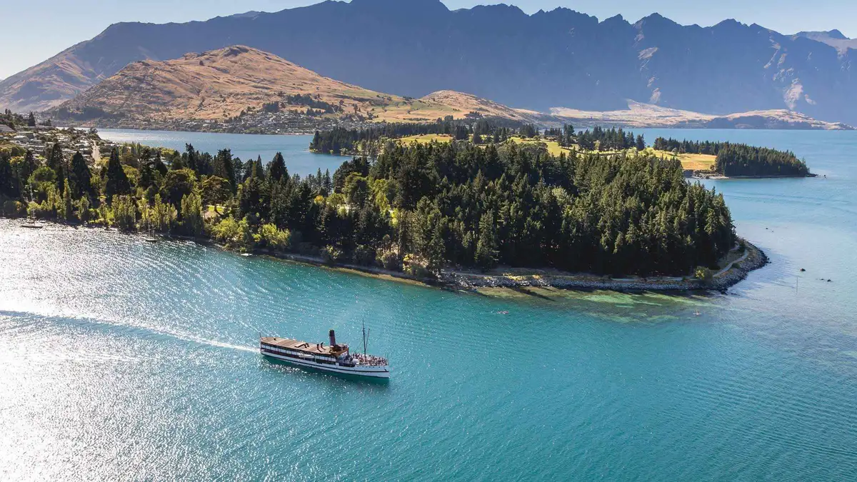
Queenstown: TSS Earnslaw Cruise of Lake Whakatipu
The steamer and nothing else: 90 minutes on the lake, the engine room open to walk through, the stokers feeding the coal fire in front of you. The shortest and cheapest way onto the 1912 vessel.
Check Availability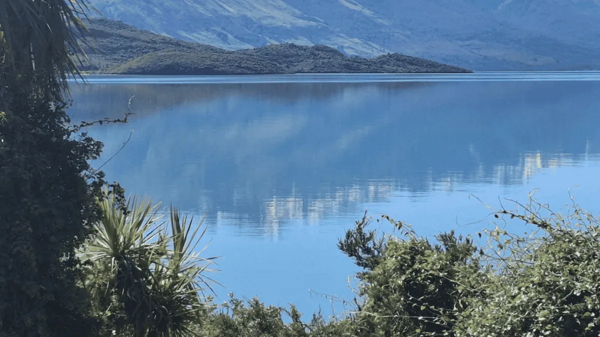 from $108.29
From Queenstown: Kayak Tour in Lake Wakatipu with pickup
A guided paddle to Pigeon or Pig Island, which this operator has exclusive landing rights to, with a short walk ashore and refreshments on a beach nobody else uses. Two and a half hours in double sea kayaks.
Check Availability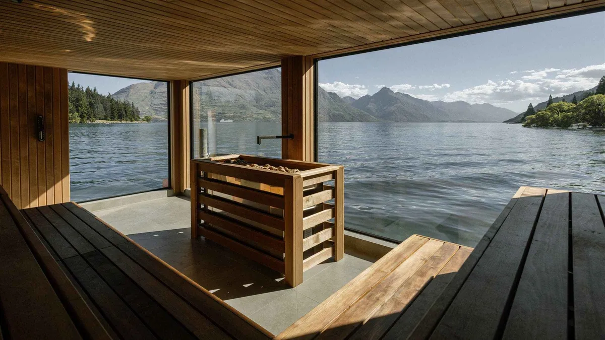 from $38.05
Most booked
from $38.05
Most booked Queenstown: Floating Sauna Experience on Lake Whakatipu
A 60-minute session in a floating Finnish sauna moored on the lake, with cold plunges straight into the water between rounds. A short walk from Beach Street; towels and lockers provided, swimwear required.
Check Availability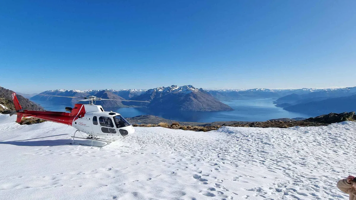 from $179.11
Queenstown: Remarkables Helicopter Flight & Alpine Landing
Twenty minutes in the air with a landing on the Remarkables Spur at around 5,000 feet, the shortest helicopter option on this page. You get out on the ridge for the view over the Wakatipu Basin.
Check AvailabilityPrices, ratings and details are the platform's own, checked in Q3 2026; dollar figures are the listed prices — the platform bills in your account's currency.
What the Kelvin Peninsula Actually Is
The Kelvin Peninsula lies between the main body of Lake Wakatipu and the Frankton Arm, the short inlet that runs into the lake's northern shore, and it ends at the arm's outlet into the Kawarau River. The centre of Queenstown is on the opposite shore of that arm, which is the geographic fact behind every photograph taken from up here.
The peninsula has two distinct parts. The eastern one is a rounded mass dominated by Peninsula Hill, 834 metres, and the western one is a smaller extension largely occupied by Queenstown Golf Club. The suburb of Kelvin Heights sits on the narrow isthmus between them, which is why it feels like a place with water on both sides: it is. Peninsula Road runs along the shore of the arm at the foot of the hill and links the whole thing to State Highway 6 close to Frankton, and that road is the only road in.
The name has changed twice. The peninsula was formerly called Kelvin Heights Peninsula and is now officially Kelvin Peninsula, with Kelvin Heights retained for the suburb. Before that, European settlers called it the Kawarau Peninsula. And before any of that it had a Ngāi Tahu name, which is the better story.
One piece of the peninsula is closed and it is worth knowing before you plan a walk around it. Deer Park Heights, a prominent part of Peninsula Hill with several former film locations and a range of farm animals, once had public access from Peninsula Road. That access closed in 2009, and the Otago Daily Times reported at the time that the owners were, in their own words, too old to keep running it. It has not reopened.
Te Nuku-o-Hakitekura: the Name Before Kelvin
The original Ngāi Tahu inhabitants called this peninsula Te Nuku-o-Hakitekura, the Expanse of Hakitekura, and the name is recorded in Kā Huru Manu, the Ngāi Tahu atlas of traditional place names. Hakitekura was a Kāti Māmoe woman and the first person known to have swum across the lake; several other geographical features nearby are named for her and for that swim. The lake itself carries a Māori name in current official use, Whakatipu Waimāori, alongside Lake Wakatipu, and the lake's own page covers what that name records.
It is a better piece of context for a morning on this shore than the Victorian one, and it is the older claim on the ground by several centuries.
The Ferry, and the Two Official Fares That Do Not Agree
This is the single fare on this site where two official publishers state different numbers for the same journey. Both are printed below with their source, because picking one and hiding the other would be the wrong service to a reader standing on a jetty.
Queenstown has a scheduled passenger ferry that belongs to the Orbus public transport network rather than to a cruise operator. It runs daily between Queenstown Bay and Frankton Marina, stopping at Bayview and the Hilton, and Bayview is the Kelvin Heights stop. You tag on with the skipper. It is the only part of the network where a bank card is accepted at all, and it is also the only part where paying that way costs materially more.
Here is the disagreement. Queenstown Ferries, the operator, publishes on its own site: with a Bee Card, one way, $10; without a Bee Card, one way, $14, adding that these are one-way fares only, that there are no concessions for over-65s or children, and that cash is not accepted. The Otago Regional Council's September 2025 Queenstown timetable booklet publishes a different ferry table for the same service: adult $2.50 with a Bee Card and $10 in cash. Those are not roundings of each other. On the card fare they differ by a factor of four.
We have not resolved it, and we are not going to invent a resolution. What we can say is which one to budget against and why. The operator's own live page is the more specific and the more recently updated of the two, and it is the page a passenger would be shown if they looked the service up today, so assume $5.84 (NZ$10) with a Bee Card and $8.18 (NZ$14) with a bank card, and treat any lower figure as a bonus rather than an entitlement. If you are travelling on a Community Connect concession, note that the operator states the concession pays the same as everyone else. The full transport picture, including how the forty-five-minute free transfer between two buses works and why it may not extend to a boat, is on getting around Queenstown.
One Boat an Hour, and It Stops at 21:45
The timetable matters more than the fare in practice. Sailings leave Queenstown Bay hourly from 08:45 until 21:45, and the Hilton and Frankton side hourly from 08:15 until 21:15. That is one boat an hour, not a shuttle.
Nobody publishes the crossing time, on either the operator's page or the council's, which is a strange gap for a scheduled service and one we could not fill from an official source. Miss the 21:45 and your options are Route 3 the long way round with a change at Frankton, or a taxi, and the taxi is not a short one because the road follows the shore of the whole arm.
Route 3 Does Not Go to Town
This catches people, and it is worth stating flatly before you book. The Otago Regional Council publishes Route 3 as running Kelvin Heights to Quail Rise. Both of those are residential ends of the basin, and the route's path between them goes round the head of the arm through the Frankton hub. It does not enter the Queenstown town centre.
So a bus journey from here to the centre is two journeys: twenty scheduled minutes from Kelvin Heights to the Frankton Bus Hub on Route 3, then ten more from Frankton into Stanley Street on Route 1. The saving grace is the transfer rule. With a Bee Card, if you tag on and tag off, a second bus within forty-five minutes is free, so the whole trip costs one $1.46 (NZ$2.50) adult fare rather than two. Without the card you pay $2.34 (NZ$4) twice, and the card itself costs NZ$5 with a NZ$5 minimum top-up, so it repays itself quickly from this address.
What we did not read for this page, and therefore do not state, is Route 3's own first and last departures. The council publishes running times between timing points in its booklet, which is where the twenty minutes comes from, but the service pattern for that route was not confirmed here. Route 1, at the Frankton end of your journey, runs from 06:02 to a last departure at 00:25 seven days a week, so the constraint on a late night home is almost certainly Route 3 rather than the connection, and the ferry's 21:45 is earlier than either.
The honest summary: treat the ferry as your route home and the bus as the daytime workhorse, and if you are out past ten in the town centre, know before you order the second drink whether you are walking to a taxi rank or to a jetty.
The Price Band Rests on Five Properties
The figures below come from a Google Hotels query run through DataForSEO for a single midweek night, Wednesday 21 October to Thursday 22 October 2026, two adults, priced in New Zealand dollars and converted at NZ$1 = $0.584. This is the one area on this site where the sample is thin enough that the caveat matters more than the number.
Nine Kelvin Heights properties came back and five of them returned a price. Five. The middle half of those five ran NZ$273 to NZ$397, which is $160 to $232, and the full priced sample ran NZ$228 to NZ$464, about $133.20 to $271.
A middle half calculated across five values is not a market rate; it is an indication. To test it we ran a second, differently worded query at the same area on the same night, and it returned a band of NZ$237 to NZ$345, about $138.40 to $201.50. That keeps the shape, a mid-range area sitting above Frankton and below the top of the town centre, but it does not settle the figure, and the gap between the two readings is larger than the precision anyone should claim.
What you can take from it: Kelvin Heights is not a budget area and it is not a luxury one either, the inventory here is small, and a peninsula with nine properties in a Google Hotels sample and 1,220 residents is a place where a single event or a single weekend moves the whole picture. Book earlier than you would elsewhere for that reason rather than for a crowd reason. And read this band beside all six on where to stay in Queenstown, where the sample sizes print alongside the numbers.
One local number does explain the price floor. The New Zealand Herald reported in 2007 that Kelvin Heights had become the first suburb in the country with a median house value of about a million dollars, as at 2005. Whatever has happened to that figure in the twenty years since, this has been an expensive piece of ground for a long time, and there is no cheap end of it in the way there is in Fernhill.
| Reading | Middle-half band | Priced properties | What it tells you |
|---|---|---|---|
| Our main query, 21-22 October 2026 | $160-232 (NZ$273-397) | 5 of 9 | A mid-range area, but on five values |
| A second, differently worded query, same night | $138.40-201.50 (NZ$237-345) | 5 of 9 | Same shape, a materially different number |
| Full priced sample, main query | $133.20-271 (NZ$228-464) | 5 of 9 | No cheap end of this area exists |
| Frankton, for comparison | $105-150 (NZ$179-257) | 12 of 20 | The narrow, reliable alternative |
| Queenstown town centre, for comparison | $119-269 (NZ$203-460) | 20 of 20 | The only complete sample of the six |
The Golf Course, and the Ranking Nobody Publishes
Queenstown Golf Club occupies most of the western extension of the peninsula, which means it takes up a substantial share of the land you can see from the town, and it is the reason a good many visitors come across the water at all. Its position is genuinely unusual: water on three sides, the Remarkables on one horizon and Coronet Peak on another.
The question the search results ask is which is the best golf course in Queenstown, and the honest answer is that no authority publishes one. There is no official New Zealand ranking of Queenstown courses that we could read, no council or tourism-board list that grades them, and the rankings that circulate are magazine features rather than a governing body's assessment. Naming a winner here would be repeating someone's opinion as a fact.
What can be said is the geography: the peninsula course is the one you can reach on the ferry and Route 3 rather than by car, which is not true of the alternatives out towards Arrowtown and the Crown Range. We did not read green fees, tee-time rules or visitor conditions from the club for this page, so nothing of that kind is printed; check the club directly before you plan a round around it.
The Trail Around the Shore
The Queenstown Trail runs between the suburb and the Frankton Arm shore, and it is the best free thing on this side of the water. The Queenstown Trails Trust publishes its Kelvin Heights Trail at 9.3 kilometres, one to two hours by bike or two to three hours on foot, and it links at the Kawarau Falls Bridge to the Frankton Track, which is the 8.5-kilometre run along the other shore into the Queenstown Gardens. The Trust also publishes the two together as a single 16.4-kilometre ride from the Queenstown Gardens to Jardine Park, one to two hours by bike one way.
That combination is what makes a car-free day on this peninsula genuinely good rather than merely possible: ride or walk the shore to the Kawarau Falls Bridge, which has been foot and bike access only since 2018, cross it, and come back along the other side into town. The Trust's Kelvin Heights Sculpture Trail is published as a separate route on the same ground.
The network costs nothing to use. The Queenstown Trails Trust is a charitable trust that funds the trails through donations and sponsorship, publishes no ticket, pass or charge, and asks only for a voluntary contribution. Note one thing about its published times: the Trust's figures are bike times unless it says otherwise, so a two-to-three-hour reading on a trail page is often a riding estimate rather than a walking one. Where a walking figure exists, as it does here, it is the higher of the two. And note the 2026 detour on the Frankton Track at the far end, which runs along the sealed footpath beside Frankton Road while infrastructure work goes on: the Frankton page has the detail. More of the walking network is on Queenstown walks, and the basin's hardest published day walk, five to eight hours return on the mountain behind the town, is on the Ben Lomond track page.
Who Lives Here, and Why It Is So Quiet
Kelvin Heights covers 9.28 square kilometres and had an estimated population of 1,220 in June 2025, which is a density of 131 people per square kilometre; the same figures for Frankton are 3,990 people at 528 per square kilometre. At the 2018 census the median age here was 43.4 years against 37.4 nationally, 19.5 per cent of residents were 65 or older, and the median income was NZ$44,800 against NZ$31,800 across New Zealand. Nearly nine in ten residents identified as European or Pākehā.
Those numbers describe the evening you will have. This is an established, older, wealthier residential suburb, not a visitor district, and it behaves accordingly: no late kitchens, no shops open at nine, no street with people on it after dark. The suburb is also home to a Christian camp that has been running for more than fifty years, which is the other kind of visitor this shore has always had.
What that means for a stay is straightforward. If you want to look at Queenstown rather than be in it, and you will use the boat as a daily habit, this is the best version of that trade in the basin, and the outlook from a room here across the arm to the town and the ranges behind it is the reason people pay for it. If you want to walk out of your door to something, anything, at nine in the evening, this is the wrong shore, and the two areas that answer that are the town centre and, at a lower price, Fernhill with its twelve-minute bus.
Who Should Not Stay in Kelvin Heights
Four kinds of visitor should book elsewhere, and the reasons are all timetable reasons rather than quality ones.
Anyone without a car who intends late evenings. The last ferry leaves Queenstown Bay at 21:45. That is early for a town whose best-known food window trades until half past two, and the alternative after it is a bus route that does not enter the centre or a taxi round the whole arm.
Anyone on one or two nights. The crossing is a pleasure the first time and a logistics problem the third. On a short stay you will spend a meaningful share of your waking hours getting to the side of the water where the things you booked actually start.
Anyone with an early flight. The airport is at the far end of the arm in Frankton, and from here that is Route 3 plus a change, or a taxi. Frankton removes the problem entirely.
Anyone booking on a tight budget. The band here ran $160 to $232 (NZ$273 to NZ$397) on a thin sample and there is no cheap end to shop for, unlike Fernhill, whose floor on the same night was NZ$89. You are paying for the outlook and the quiet, and both are real, but neither is a saving.
Kelvin Heights and the Water Between
The blue pin is Kelvin Heights on the peninsula; the green pins are the other areas with a guide on this site. The arm of water between this pin and the town-centre pin is what the ferry crosses.
Bus minutes and the ferry timetable are the Otago Regional Council's and the operator's, read in Q3 2026. Pin positions are the area centres used across this site's maps.
Next Stop From the Peninsula
Three pages that carry on where the water ends.
The fares, the ferry and the parking
The ferry timetable, the Bee Card transfer rule and every other way of crossing this basin, priced: getting around Queenstown.
One boat an hourThe shore opposite
Where the check-in desks, the late kitchens and the wharf are, with the trading hours that come with them: the town centre guide.
A ferry crossingThe lake this peninsula divides
Whakatipu Waimāori, its depth, its tides and what you can actually do on it: the Lake Wakatipu page.
Water on both sidesWhat a Night Costs Here, With the Caveat Attached
The band under each area is the middle half of the nightly rates Google Hotels returned through DataForSEO for a midweek night, Wednesday 21 October to Thursday 22 October 2026, two adults, priced in New Zealand dollars and converted at NZ$1 = $0.584. It is a reading of one date, not a quote, and on this peninsula it is a reading of a very small sample.
Kelvin Heights
- Into the town centre
- The Orbus ferry from the Bayview stop across to Queenstown Bay, or 20 minutes by Route 3 to the Frankton hub and then a change
- Typical double
- $160–232 (NZ$273–397)
- Suits
- Golf, the ferry as a daily habit, and looking back at the town rather than standing in it
Only five of the nine properties queried returned a price, so treat this band as indicative rather than solid. A differently worded query on the same night came back at NZ$237 to NZ$345, which keeps the shape but does not settle the figure. There is no cheap end of this area to shop for.
See stays in Kelvin HeightsQueenstown town centre
- Into the town centre
- Everything on foot; the Stanley Street hub takes Routes 1, 4 and 5 and the wharf is about five minutes from it
- Typical double
- $119–269 (NZ$203–460)
- Suits
- Late evenings, no timetable, and every operator check-in desk within a few hundred metres
Twenty priced properties out of twenty, the only complete sample of the six areas. It is the shore this peninsula looks at, and the one you have to be on before 21:45 if the ferry is your way home.
See stays in Queenstown town centreFrankton
- Into the town centre
- Round the head of the arm: the Route 3 change point, and 13 scheduled minutes from there into the town centre
- Typical double
- $105–150 (NZ$179–257)
- Suits
- Early flights, a hire car, a supermarket shop and a nightly number you can predict
The tightest band of the six on twelve priced properties, and the practical alternative if what you want from this side of the water is quiet plus errands rather than quiet plus a view.
See stays in FranktonRates read in Q3 2026 for one midweek October night and quoted as a band, not a price. There is no bed tax or visitor levy on top of them, and GST is already inside a New Zealand advertised rate. All six areas, on the same date and with their sample sizes, are compared on where to stay in Queenstown. We take a commission if you book through these links, at no extra cost to you.
Kelvin Heights: Questions
How do you get from Kelvin Heights to Queenstown?
Two scheduled ways. The Orbus ferry crosses from the Bayview stop to Queenstown Bay, hourly, with the last sailing out of Queenstown Bay at 21:45 and out of the Hilton side at 21:15; nobody publishes the crossing time. Or Route 3, which the Otago Regional Council times at twenty minutes to the Frankton Bus Hub, followed by a change onto Route 1 for another ten minutes into Stanley Street, with the second bus free inside forty-five minutes if you use a Bee Card. The crossing table has both, plus the trail and the drive.
How much is the ferry across to Kelvin Heights?
Two official sources disagree, and this page prints both. Queenstown Ferries, the operator, publishes $10 one way with a Bee Card and $14 without, with no concessions and no cash accepted, which is $5.84 and $8.18. The Otago Regional Council's September 2025 timetable booklet publishes an adult ferry fare of $2.50 with a Bee Card and $10 in cash. Budget against the operator's figures, since its page is the more specific and the more recently updated, and treat anything cheaper as a bonus. The full account is here, and the rest of the network's fares are on getting around Queenstown.
Is Kelvin Heights a good place to stay without a car?
Yes for daytime, with a caveat for evenings. The ferry and Route 3 both run, the Bee Card transfer makes the bus change cost one fare rather than two, and the 9.3-kilometre trail along the shore is a genuine third option. The catch is the 21:45 last sailing and the fact that Route 3 does not enter the town centre at all, so a late night out has to be planned rather than improvised. If unplanned evenings matter more than the outlook, the town centre is the answer.
What is there to do on the Kelvin Peninsula?
Three things, and two of them are free. Queenstown Golf Club occupies most of the western part of the peninsula. The Kelvin Heights Trail runs 9.3 kilometres along the shore, published at two to three hours on foot or one to two by bike, and joins the Frankton Track at the Kawarau Falls Bridge to make a 16.4-kilometre loop back into the Queenstown Gardens. And there is the view itself. What is closed is Deer Park Heights on Peninsula Hill: public access from Peninsula Road ended in 2009 and has not returned. More walking is on the Queenstown walks page.
What was the Kelvin Peninsula called before?
Te Nuku-o-Hakitekura, the Expanse of Hakitekura, in the Ngāi Tahu naming recorded in the Kā Huru Manu atlas. Hakitekura was a Kāti Māmoe woman and the first person known to have swum across the lake, and several nearby features are named for her and that swim. European settlers first called it the Kawarau Peninsula, then Kelvin Heights Peninsula, and the official name is now Kelvin Peninsula with Kelvin Heights kept for the suburb on the isthmus. The lake page covers the water itself and its own Māori name.
Why is accommodation on the peninsula so expensive for what it is?
Because it has been expensive ground for a long time and there is very little of it. The New Zealand Herald reported in 2007 that this was the first New Zealand suburb to reach a median house value of about a million dollars, as at 2005, and Statistics New Zealand counted an estimated 1,220 residents across 9.28 square kilometres in June 2025. Only nine properties came back in our accommodation query and five of them carried a price, so the band of $160 to $232 (NZ$273 to NZ$397) is indicative rather than firm. The sample sizes for all six areas print on where to stay in Queenstown.
The Peninsula on Video
Three films from this side of the water: a drive through the suburb, a case for it, and the walk along the shore that most visitors never take.
Kelvin Heights: Queenstown's Most Underrated Suburb
The outlook back across the arm to the town, which is what a room on this peninsula is actually sold on.
Video: Adelle and NevKelvin Heights, a Queenstown Suburb in New Zealand: 4K Driving Tour
Peninsula Road end to end, useful for seeing how far it is round the arm by car.
Video: Walk n RollKelvin Heights to Jacks Point: Day Walks New Zealand
The shore walking on this side of the water, filmed on the trail network the Trust maintains.
Video: Queenstown New ZealandVideos load from YouTube only when you press play.
Reviewed Q3 2026 (July–September 2026); next review Q4 2026. Prices, hours and terms are set by the venue or operator and confirmed at checkout.
We may earn a commission if you book through one of our links, at no extra cost to you. Full affiliate disclosure